Country estate management is complex, with map requirements covering everything from visitor services to mineral extraction
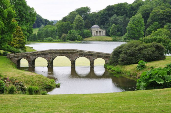 Managing a large rural estate is an increasingly complicated business, often involving a diverse range of on-site activities including farming, forestry, public events, weddings and even mineral extraction. Today, a single estate may be dealing with a complex set of issues related to diverse activities such as glamping and whether to invest in a solar farm renewable energy scheme.
Paper maps have always played a part in understanding and managing country estates, but more technical mapping solutions are often overlooked. Using a mapping consultancy or implementing your own in-house Geographical Information Systems (GIS) with Ordnance Survey mapping can be a wise investment.
Here we look at 5 ways in which mapping systems can aid estate management.
Property and Ownership Management
Country estates can often have a complex ownership structure, for instance:
- areas of land can be owned by different generations
- farm land or properties may be rented out to tenants
- areas of land may have differing access agreements
- land may be sold off for development
This information is rarely static for long. Boundaries can be drawn within your GIS or Land Registry boundaries can be obtained directly from the Land Registry and imported. You can then add information to the boundary areas to give you the current picture, and use it to produce your own maps and plans.
Tree and Footpath Management
Public access means responsibilities. Recording your footpaths, trees and their maintenance helps you to make informed decisions and avoid any unwanted legal action. You may have already had a tree survey carried out by a contractor using GPS compatible technology, if so their data can usually be outputted in a suitable format to allow further use in maps or mapping software.
Utilities Management
Knowing where your utilities are located is both useful for planning and vital in an emergency. Whether it’s pylons, cables, water mains, drains or stop cocks, they can all be added to your estate management mapping system with relative ease. It also means you don’t have to rely on the one person who retains all this knowledge in their head and hasn’t documented it!
Maps for Contractors
Measuring areas such as formal lawns, fields or woodland is easy with a GIS or mapping system. Giving an external contractor accurate measurements and printing off custom paper maps means there’s no excuse not to get an accurate quote for grounds maintenance and have your tasks carried out efficiently.
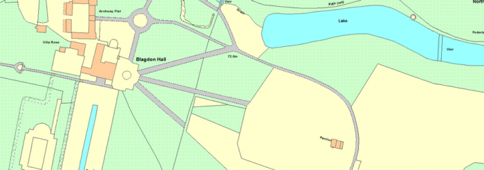
GIS mapping for Blagdon Estate. Read more in the case study
Creating Custom Maps for Events
Expecting visitors? Even a small event can benefit from a printed map with custom routes and areas marked and can be produced easily from a GIS. Using an estate map will help visitors with orientation and navigation and potentially save on the number of Marshalls needed for the day. Ensure your hosts have all the information they need to help your event run smoothly and safely, and visitors understand the context of their location and the scale of the estate.
Lovell Johns has provided a number of different mapping systems and services to private estates, whether providing GIS software and training to an 8,000 acre rural estate or building a Biodiversity GIS dataset for a University Estate Department.
Comments are closed here.