What are the benefits of online, interactive Proposals Maps for Local Authorities?
The Proposals Map (or Policies Map) is a series of maps published periodically by all Local Authorities that show locations where different land use policies apply.
Specifically it is the visualisation of land use within the council area showing designations, site allocations or safeguarded areas over Ordnance Survey base mapping. The Policies Map provides developers, local communities and other interested parties with a clear geographic representation of the planning policies in force at the time of publication.
As a statutory document forming part of a council’s Local Plan Policy, the Policies Map has always been available in printed format. The printed version will be used by council members and purchased by members of the public and developers with an interest in local planning policy and land use information. More recently the growth in Neighbourhood Plans as a result of the Localism Act 2011 has seen an increased need to publish similar small scale planning maps.
Interactive, searchable and scaleable
The general growth in interactive mapping provision by councils, coupled with the increased appetite for online information on the part of citizens has seen a change in the way the Policies Map information is delivered by councils. The increased usage of mapping through mobile devices, made available through APIs such as Google Maps and Bing Maps, combined with the growth in open source software has provided increased opportunities and different routes to market for developers.
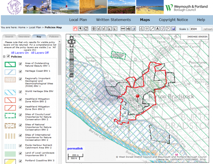
Going digital through online mapping means going beyond the static PDF provision found on some council websites to a zoomable, clickable interactive map where the user can search by address then link to specific on screen policy information. The online Policies Map has the advantage of potentially providing very large scale mapping for the whole of the borough or district that would not be possible for a paper format map.
Increasing engagement
The online Policies Map provides increased user engagement by providing public, developers and even council staff with a free, intuitive information around the clock.
Another advantage from the digital age of mapping is how easily and quickly the online Policies Map can be updated in comparison to the printed map. Most online mapping systems come with a library of files which can be easily amended or updated for a new policy or layer of information. In comparison, the printed map of course requires re-printing.
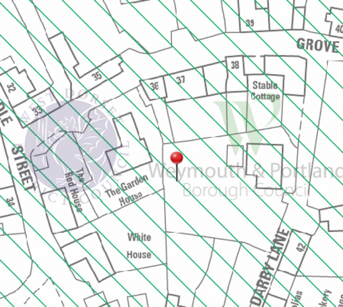
Online mapping has also proved popular with the local authority Planning Policy Officers as many of the questions raised via telephone calls can be resolved through a mapping interface; for example the citizen wishing to know if their home address is within the Green Belt can quickly resolve this online by searching on a full address then zooming into their property at a scale of 1:1,250.
Lastly, the online map has the advantage of linking to specific policy text from embedded links within the interactive map meaning the user can quickly read up on the planning policies applicable at the search point rather than have to refer to a separate document. We’ve come a long way from our web mapping solutions first released in 2007 and Planvu 3 provides an interactive, intuitive map of planning policies all the way down to property level. So one can search for a full address and links to detailed planning policies.
Comments are closed here.