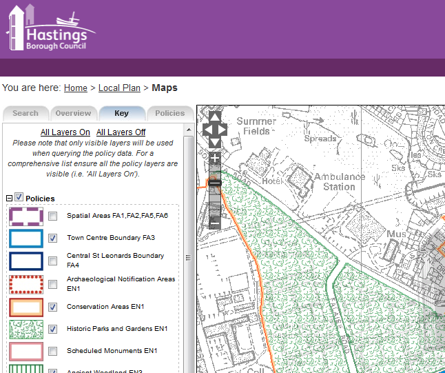
Our GIS mapping software planvu, has been provided to 3 further District Councils in the last Quarter meaning members of the public in the counties of Somerset, East Sussex and Hertfordshire are now able to search on interactive mapping showing Local Plan information over familiar Ordnance Survey base mapping.
Planvu software has been fully developed since 2007 by our own team of GIS and software developers. The software provides Local Government with a highly efficient and intuitive website based interactive map experience, allowing developers and general public to search by postcode and street name, then query the Planning Policies and associated Planning restrictions in their area. The internet mapping solution is proving increasingly popular as it helps to reduce expenditure on maps.
In addition to the 11 existing customers, Mendip District Council, Hastings Borough Council and Uttlesford District Council have now been added to the available example at www.planvu.co.uk. We are also soon to release a new solution for our first Scottish Council in Midllothian!

Comments are closed here.