Requirement
The global maritime services provider, Inchcape Shipping Services (ISS), were seeking to create a comprehensive library of maps showing the layout of leading commercial ports. The maps were required to add value to the recently launched ISS World of Ports website, a new online database offering information on all major wet cargo terminals and berths worldwide. ISS saw an opportunity to offer something more detailed and bespoke than was available on Google Maps or on competitor’s offerings.
Solution
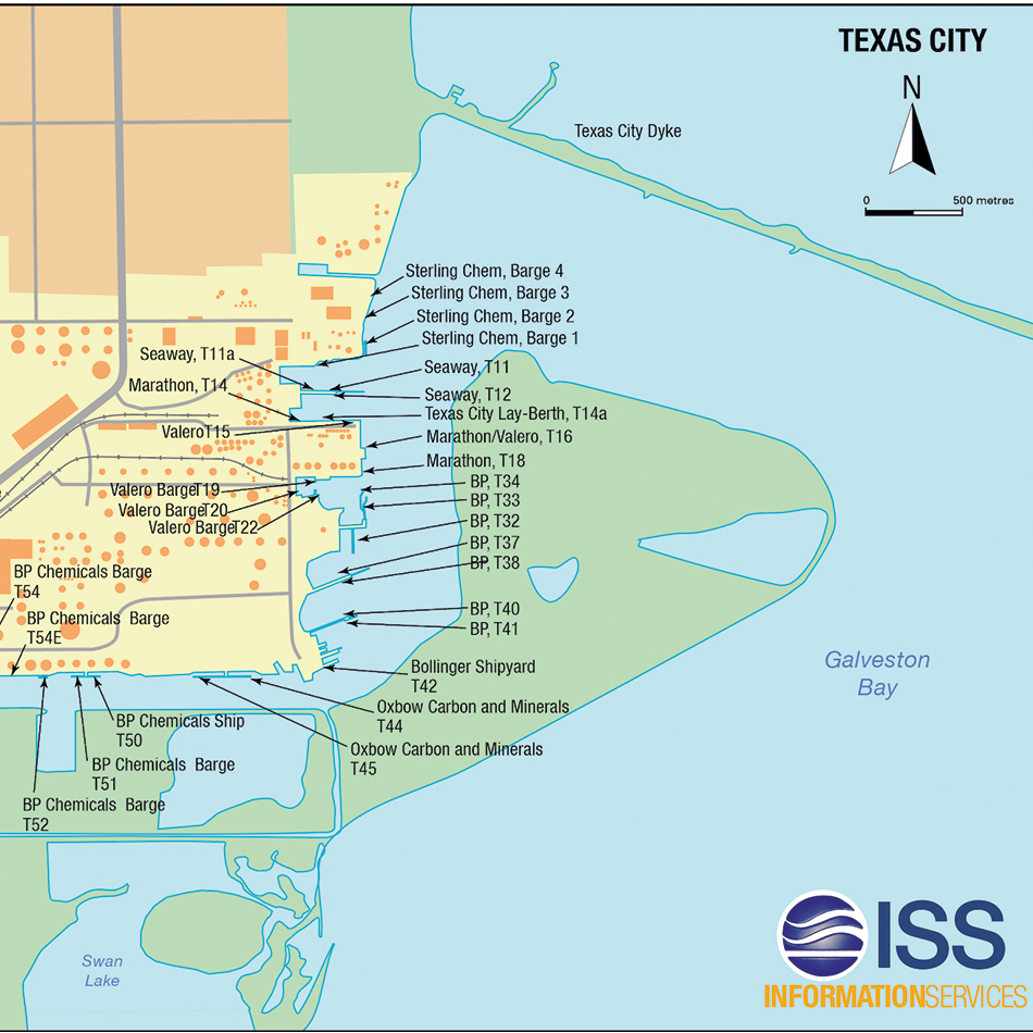
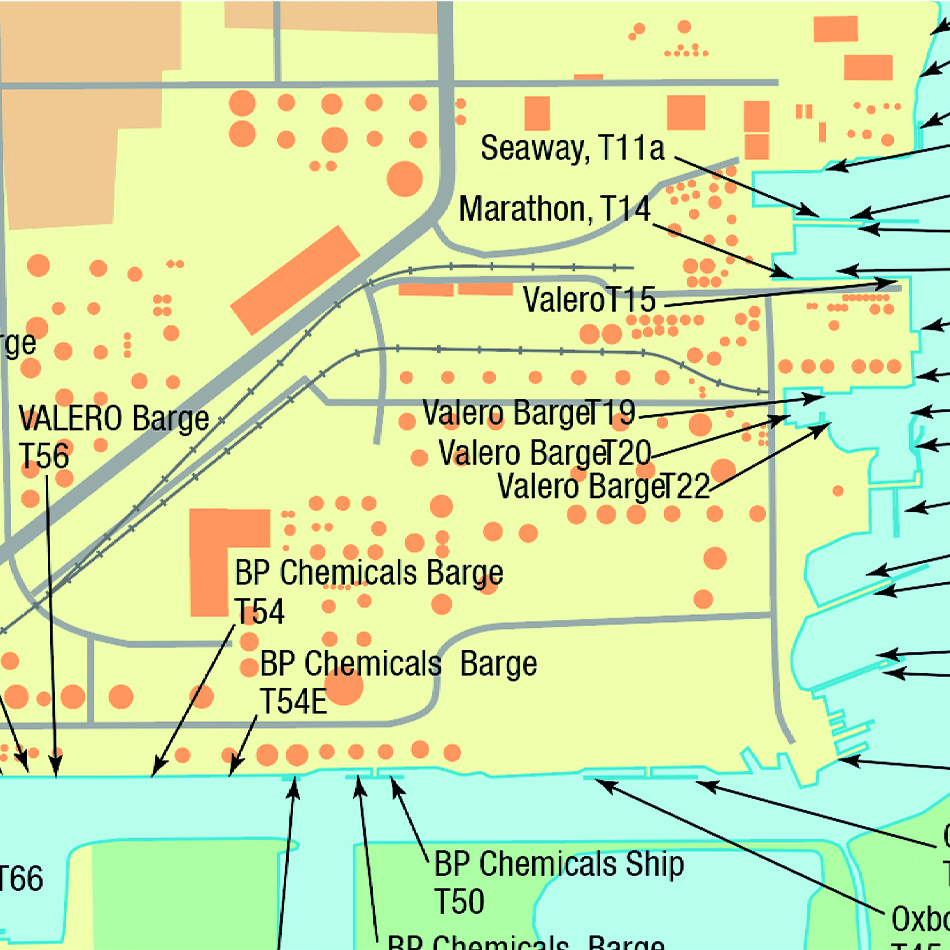
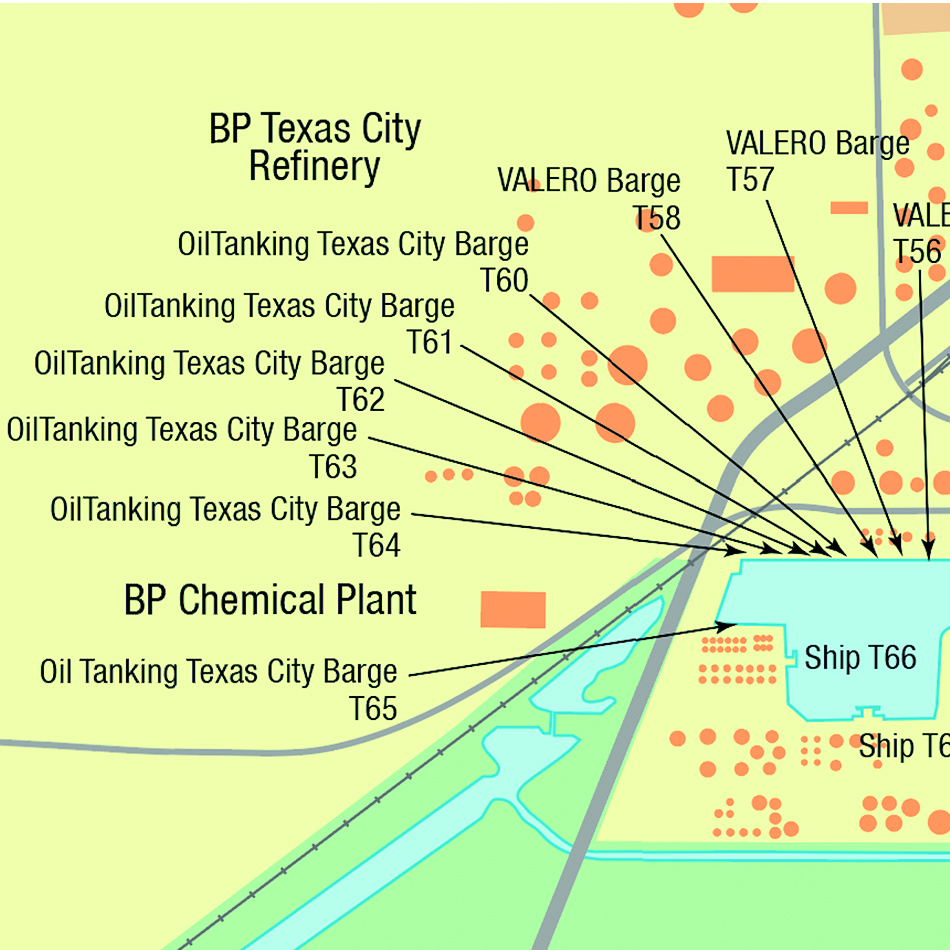
Using original research and out of copyright sources, a sample port plan was quickly produced for sign -off by ISS. With hundreds of ports to choose from, ISS provided Lovell Johns with shortlisted targets in order of priority. Data was sourced for each target then overlaid with the specific port information and styled in a clear way to optimise viewing on the web and ensure consistency across the library of maps. Each JPEG image file was checked by local ISS staff for accuracy prior to submission to the World of Ports website.
Result
Lovell Johns have to date produced more than 300 port plans, with more planned for the future. The plans were all tagged to the World of Ports website search facility, allowing subscribers to search and view detailed maps of commercial ports worldwide. As a result, ISS shipping customers are benefitting from finding useful information such as berth names and numbers on a single website resource.