Illustrations can really bring a map and subject matter to life, from highly detailed and lifelike graphics to fun cartoons for children. Illustration is a valuable way of showing information and from our very early days Lovell Johns has always had the skills and ability to produce illustrations. Our strap line was originally “Cartographic Design and Illustration”.
Originally all of our illustration work was produced freehand either as a pen drawing or painting. We would usually produce the illustration at a larger size and then reduced it photographically for the final output. Today we can use software to help the process and improve the accuracy of illustrations, this also makes last minute alterations much easier.
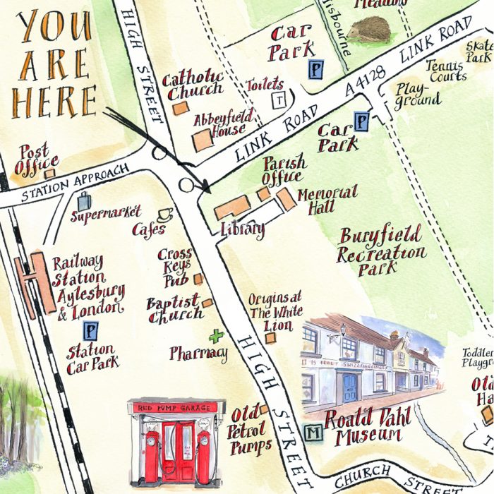
Lovell Johns have a wide range of illustration styles which can be brought into a custom map commission, using both hand-drawn and digital techniques to bring a map to life. Our illustrators are also available to make site visits, to take photographs, make initial sketches and get a feel for the location.
Our cartographers use various styles and techniques in illustrated mapping such as:
- The use of perspective to give the map a 3 dimensional aspect
- Focusing on key features or landmarks in an illustrated style to bring the map to life
- The morphing of certain geographic features such as foreshortening
We can illustrate buildings, landscapes or specific subject matter.
Perhaps as a reaction to many bland generic mapping styles, clients are increasingly asking for illustrated mapping styles to add personality to their publications.
The illustrator will work with the client and produce an initial sketch, to an agreed coverage. This gives the customer the chance to comment and for any amends to the layout to be made. Once the sketch is approved, the artist will work on a final version of the file. Some artists create a watercolour base, then add text and illustrations to this. Some may draw the detail in by pen, depending on the style required for the project. Files are supplied as layered Photoshop files, so that text and illustrations can be moved if required. We are available to make later changes and adjustments to the image, or to produce different versions to highlight different facilities, for example, for specific events or user groups.
Some styles
- Pen and ink
- Watercolour
- Cartoon
- Rough or stylistic hand drawn
- Technical, 3D images
Applications used
- Sketch-up
- Adobe Illustrator and Photoshop