Requirement
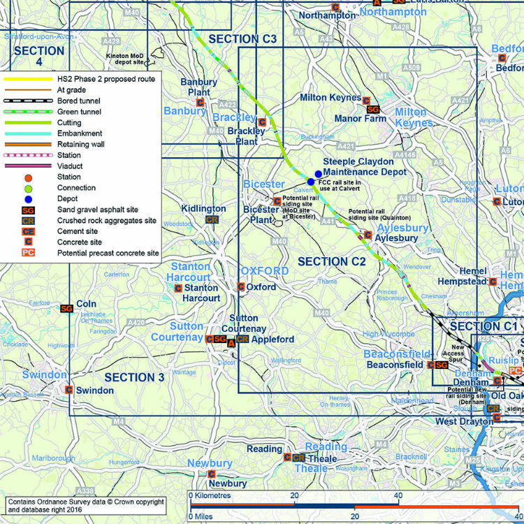
A world leading producer of construction aggregates, with 47 quarries in the UK alone, approached Lovell Johns with a custom mapping requirement. Being well-positioned to distribute materials required for the construction of the new HS2 rail line, the client needed to visualize the relative position of their various sites in relation to the proposed rail line, to be used for logistics planning and tendering.
Solution
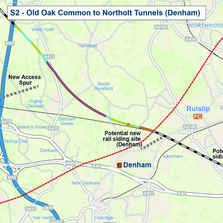
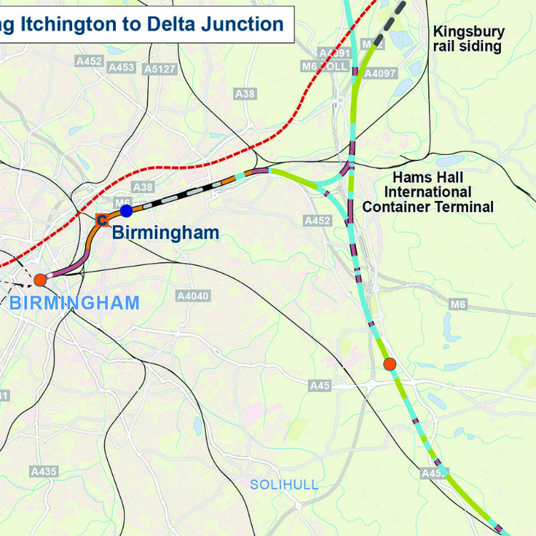
Following a meeting at our offices, the client supplied information on the location and categories of their sites. We devised an initial map base, styled to match other corporate graphics, to be used as a template for all maps. The route was broken down into several sections, showing the type of construction (Cutting, Tunnel, etc.), with more detailed areas pulled out as Inset maps. All local depots are marked as clear symbols to avoid ambiguity and named for further clarification.
Result
In total, one overview map and seven detailed maps were produced to a tight deadline, and well received by the client.