Requirement
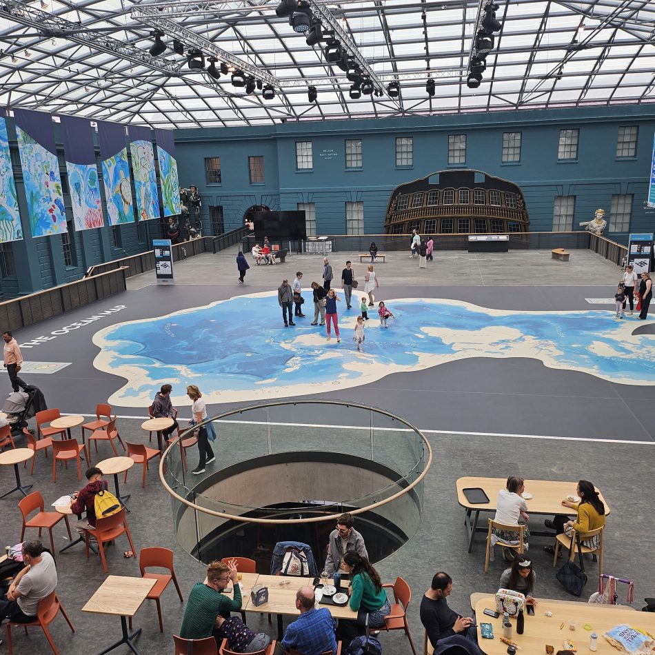
Lovell Johns were recently commissioned to provide GIS and Cartographic design services to support the launch of the National Maritime Museum Ocean Map, a giant floor map of the oceans highlighting how the Earth is covered by water. Our team consulted with the Museum stakeholders at an early stage to gain a better understanding of the space and scale of the project, also to present ideas for available bathymetry datasets, map projections and design approaches which could realise their vision.
Solution
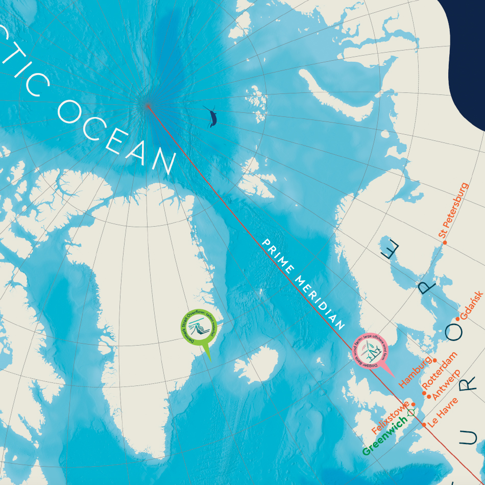
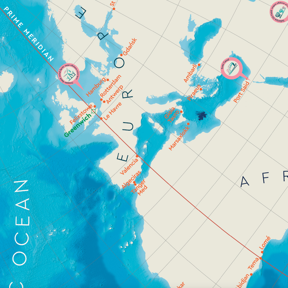
The chosen Spilhaus projection is very fitting because it presents the oceans as a continuous and connected system, helping viewers see the relationships between the seas and oceans in a new way. A global bathymetric dataset was used, built from ship-based sonar surveys and satellite measurements, providing a remarkably detailed picture of the seafloor at the required scale. However, the real challenge with this project was not accessing the data but working at such a large scale.
With the seabed detail, bathymetry and other cartographic layers exported, our cartographers were able to design an attractive, clear yet detailed map that would work in this unique setting and scale. The digital file containing all the ocean detail and depth information was extremely large, around 34 gigabytes! Due to these challenges, we developed some clever workarounds to manage the data effectively and ensure the final map was both clear and high quality.
In this particular projection, there is much less of a sense that north is always at the top. Because of this, we carefully considered the rotation and orientation of text and illustrations, created by Helen Lyon at Studio HB, to create a feeling that the map could be approached from any direction when it was on the floor of the Ocean Court. The large physical size of the map also affected the usual spacing of names across continents and oceans. We had to avoid placing labels so far apart that visitors would have to walk several metres just to read the name of a continent or ocean!
Result
Working closely throughout the process with the design kollektiv and designer Helen Lyon of Studio HB who together managed design and art direction, tiled print files were output and supplied to the specialist floor manufacturer on time to allow for printing and installation of the 26 x 17m metre map for the launch in June 2025.