Requirement
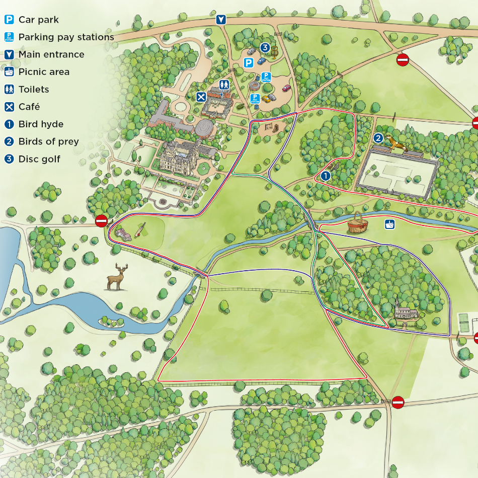
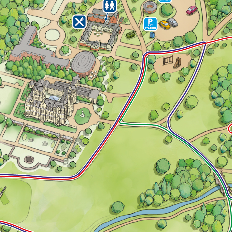
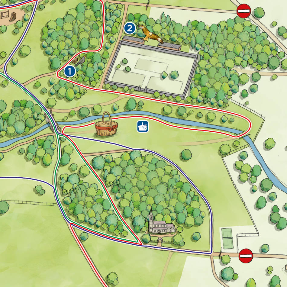
Thoresby Estate is a popular tourist destination in Nottinghamshire featuring waymarked woodland walks, a deer park and children’s play area, all within 1,000 acres of parkland. Their Events Team contacted Lovell Johns with a requirement for a new map, focused on the Park area facilities and walks on offer, to be used both as hand-held maps and on information boards.
Solution
The client referenced our Grimsthorpe Castle maps as a preferred design approach. The inception call allowed us to agree on the map angle and footprint, also to itemise the important features such as picnic area, stream, cafe, small play area, walled garden and the three walking trails.
Result
The new map has been made available as a pre-visit download here https://thoresby.com/things-to-do-at-thor/walks/