Detailed local maps with embedded hyperlinks
Requirement
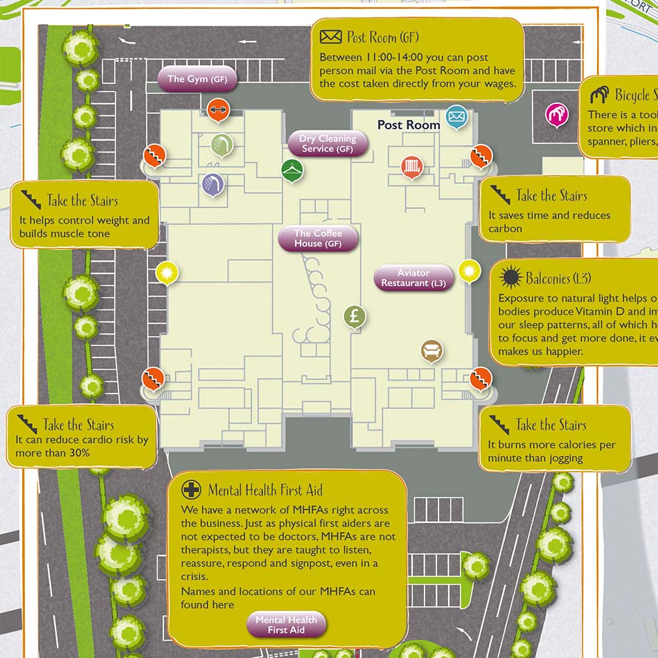
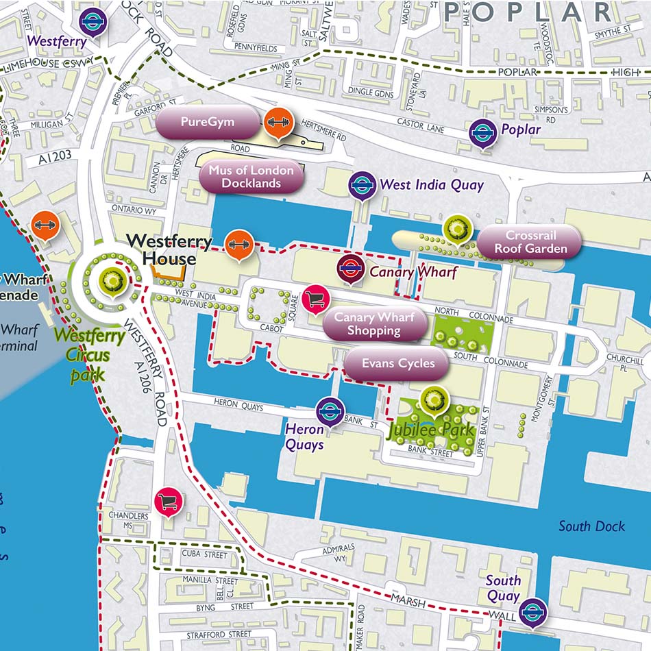
The Civil Aviation Authority employes some 1,200 staff across 4 sites in the UK and were looking for a series of local maps to assist with employee wellbeing. The CAA wanted to provide information for employees on walking and cycling routes, nearby gyms, open spaces for exercise, as well as nearby shops and food retailers.
Solution
The CAA favoured an illustrated style of map and were able to reference some existing work on our website in an initial exploratory call. They were able to provide a working list of the key features and assets to be mapped across the two priority sites. Our cartographers produced two maps, one for Westferry in London Docklands and one for Gatwick, also embedding several hyperlinks in the final map files to provide interactive links to key local facilities.
Result
The maps clearly highlight the local green spaces and available walking and cycling routes to and from the office locations. Local eating places and shops are featured in the design, along with gyms to further promote employee wellbeing. The building level detail even encourages the use of stairs over the lift.


