Requirement
Lovell Johns were contacted by Blunsdon Parish Council in Wiltshire with a requirement for a series of new maps to replace their outdated copies around the village. We engaged with the Chairman to discuss possible design styles, settling on a cost-effective approach.
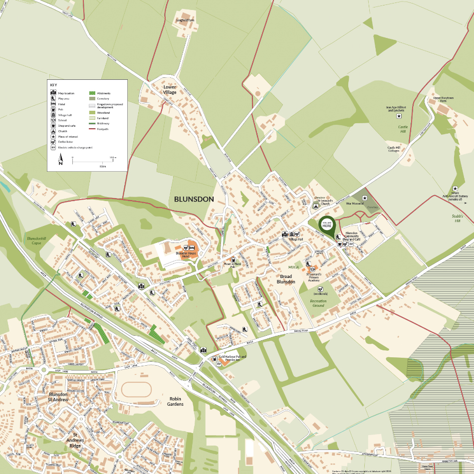
Solution
The four maps share a common base but are rotated for the different locations around the village and use ‘you are here’ markers. The Ordnance Survey royalty-free base mapping provides natural features and greenspace. A set of symbols, referenced in the key, highlight points of interest such as pubs, schools and churches.
Result
The four maps shall replace the existing ones at key points around the village. Ian Jankinson, Chairman of Blunsdon Parish Council commented ‘I must say that Louisa was excellent in the way she helped and suggested alternatives etc., thank you for your help there has been much praise for these replacements.’