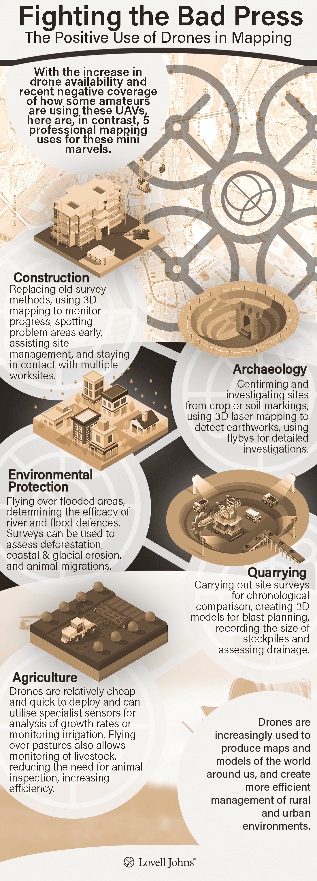
This infographic looks at five distinct sectors that are increasingly using drones for survey and mapping purposes. If you would like read a comprehensive blog post about drone use in mapping, do read our blog.
This infographic looks at five distinct sectors that are increasingly using drones for survey and mapping purposes. If you would like read a comprehensive blog post about drone use in mapping, do read our blog.