In this Blog we select 10 different approaches to illustrated maps.
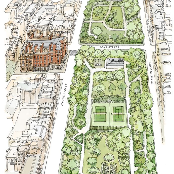
A beautiful colour illustration of a London hotel and Gardens looking up Sloane Street. Drawn in a soft watercolour style.
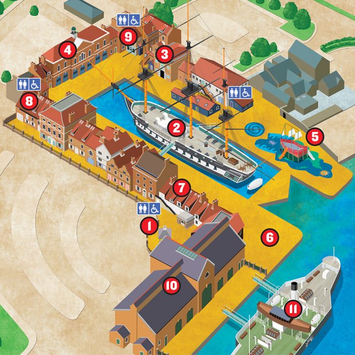
The highly illustrated map is created digitally and highlights the key Points of Interest using a numbered key.
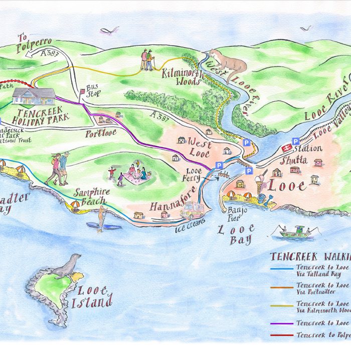
This watercolour illustrated map uses landscape and unique illustrations to encourage holidaymakers to explore the surrounding countryside ans attractions.
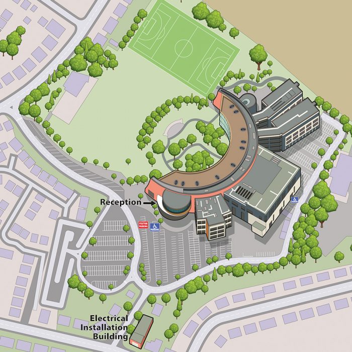
This illustrated College Map gives the user a clear sense of orientation on arrival and helps with navigation on-site.

This map illustration clearly shows the facilities available in a London park, set within its local surroundings.

A detailed artistic interpretation of Holyrood Park, showing variety in landscape and terrain.
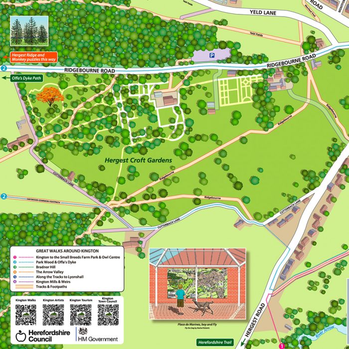
A huge map display in Kington uses illustrations to help the user find their way around the town.
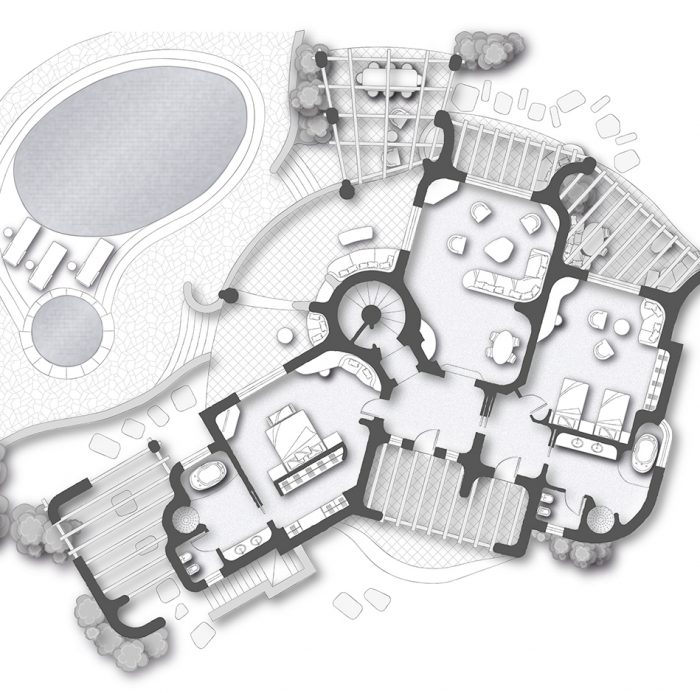
These pre-stay accomodation room plans provide guests with a distinctive guide to their upcoming visit.

This map illustration of London uses 3D building icons and a bold colour palette to convey the fun atmosphere of this charity parade.

A stylised map of London, showing the road network using a vibrant red background. The stark negative effect of this map illustration makes it a really stand-out image.
Comments are closed here.