Requirement
Bonnier Publishing are creating a new atlas of maps of the world at various stages of development and were looking for an illustrated map to go into their large format Drift Atlas.
Solution
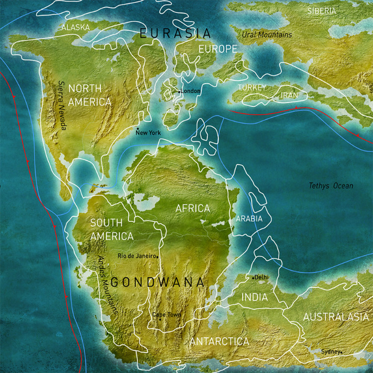
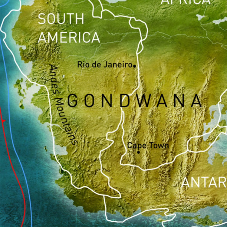
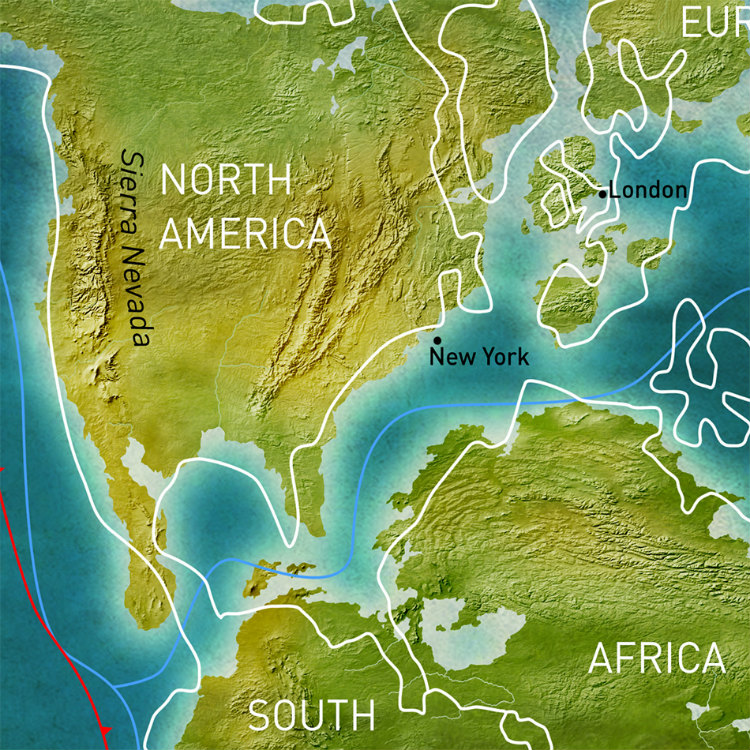
Lovell Johns used various references to create an image of how the world may have looked in the Jurassic period. Although little is known about the exact positions of landforms at this time, a sense of terrain and texture was required. The map is hand drawn with various effects to convey height and land types. The modern continents are overlaid to show how the landmasses split apart and to help with recognition. The sea was given a detailed effect to give interest to these large areas of block colour.
Result
It was a challenge to find the correct style, and so Lovell Johns provided a few different versions to help define the requirement, but the client said “Thank you so much for your team’s work on this – it’s been worth it!”