Requirement
The Council were looking for a new map resource to further enhance their Local Sustainable Transport Fund (LSTF) programme and encourage increased use of sustainable transport across the region. By seeking an interactive format, the Council were aiming to provide both a user friendly online map with links to a journey planner. As expert map makers we were well equipped to tackle a project such as this, and even lend our expertise in digital mapping through our digital arm gi Perspective.
Solution
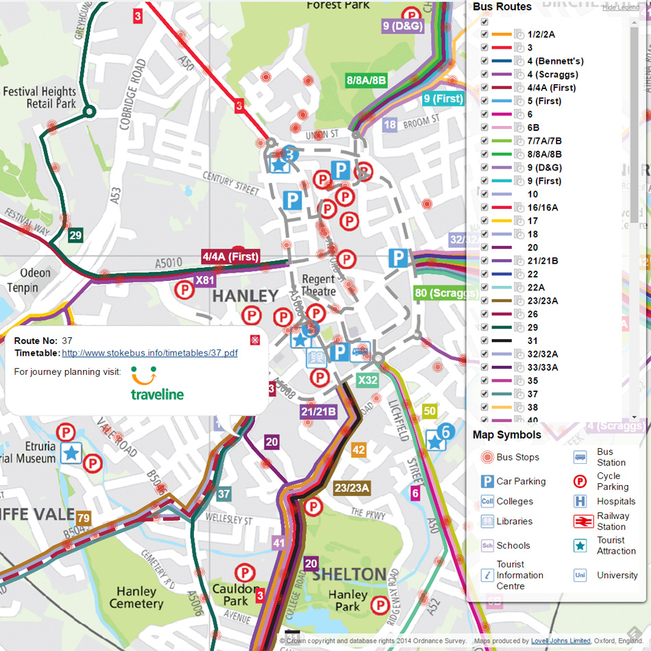
The interactive version of the map allows the user to zoom and pan around a seamless version of the hard copy map with toggle on/off bus routes and useful map symbols. When clicking on a bus route, the user can link to latest timetable information and also so for journey planning information.
Result
The project was completed to a tight schedule and both hard copy and interactive versions are supported and hosted by Lovell Johns under a 3 year Agreement.