Many of us at some point may have sought bus maps or a network map. Perhaps you’ve popped into your local bus concourse to collect a leaflet or two depicting the bus route and latest timetable information? Or you’ve very likely even downloaded a map from the bus company’s website, to print at home. It probably looks a little like the one we created for Stoke-on-Trent below.
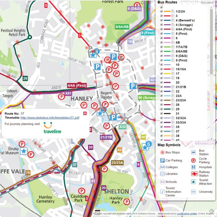
These printed leaflets, published by the local bus operator or Local Authority, will have taken many months of someone’s time to compile. There’s also the cost of the cartographic design, typesetting and of course, printing. Naturally, the big issue with this approach is that the Bus Map is effectively out of date as soon as it’s printed! With a single Bus Map potentially covering different Operators and several routes, keeping up with planned changes is a full-time job and this means that the copy you picked up from Transport Hub is of limited use.
People’s expectations of access to timely digital information have been raised in recent years. With increased use of mobile phones, the public is constantly seeking the latest information through websites and through dedicated Apps. Interactive maps are used on websites which give greater access to timetable information, as well as improved legibility, with functions to turn extraneous detail off and zoom in and out on specific areas. These maps can be easily updated as timetable changes come into effect and are therefore of more immediate use to the traveller for immediate travel as well as future transport planning.
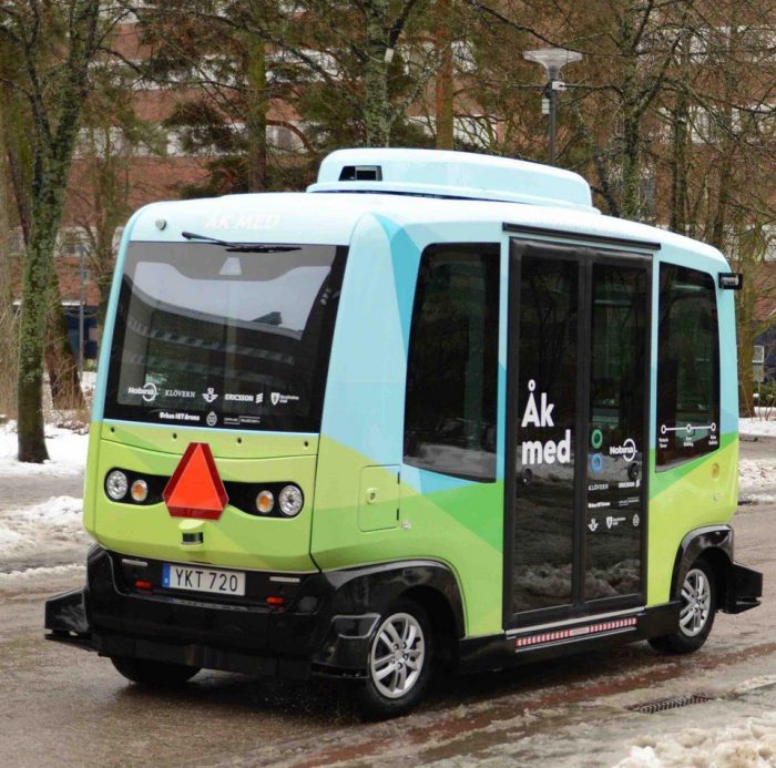
Looking to the future, interactive and mobile access to mapping and timetable information may be just the beginning in a new era of bus travel. Already, we see cashless buses, where a travel or payment card can be used to by a ticket. Free WiFi is available on many services and social media is used to convey messages about road closures and disruptions to services. In Stockholm, driver-less buses have already been introduced and are planned to be introduced in Singapore by 2022.
As the public become more educated on the benefits of sustainable travel, for bus transport (as well as other mass transit systems), the only way is up!
Comments are closed here.