Requirement
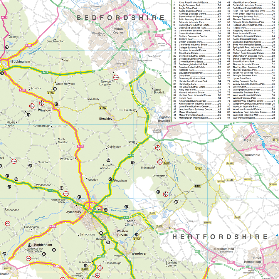
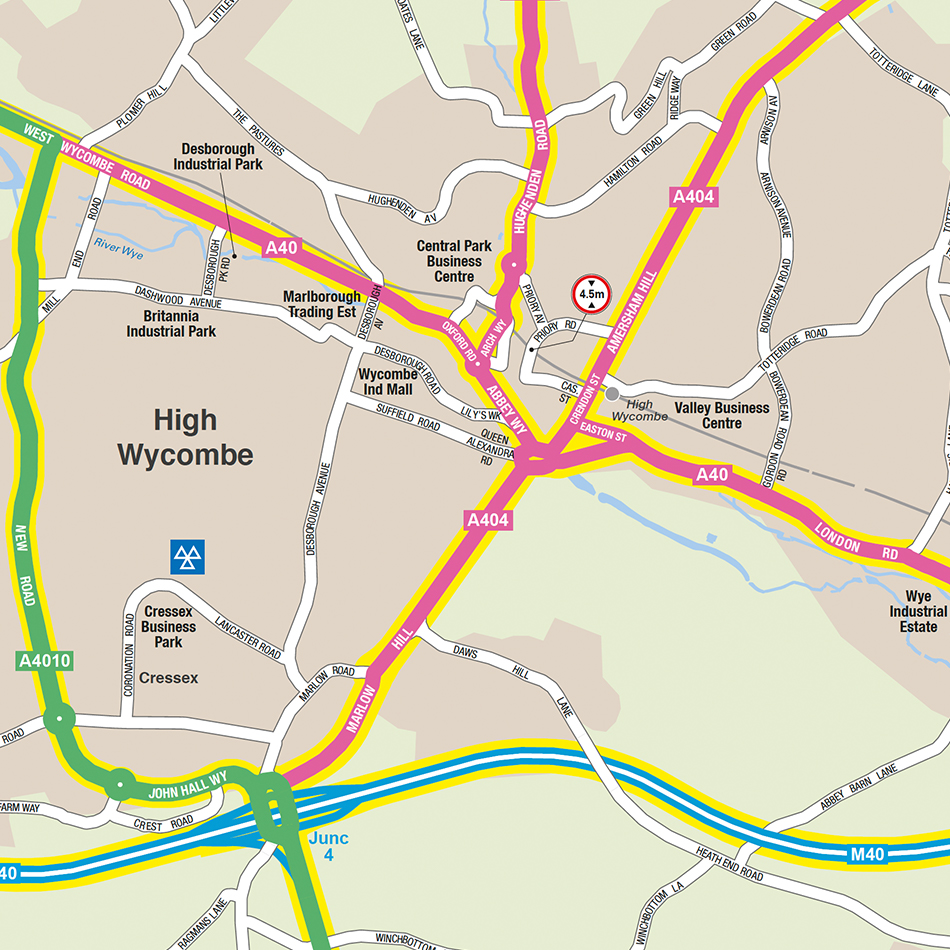
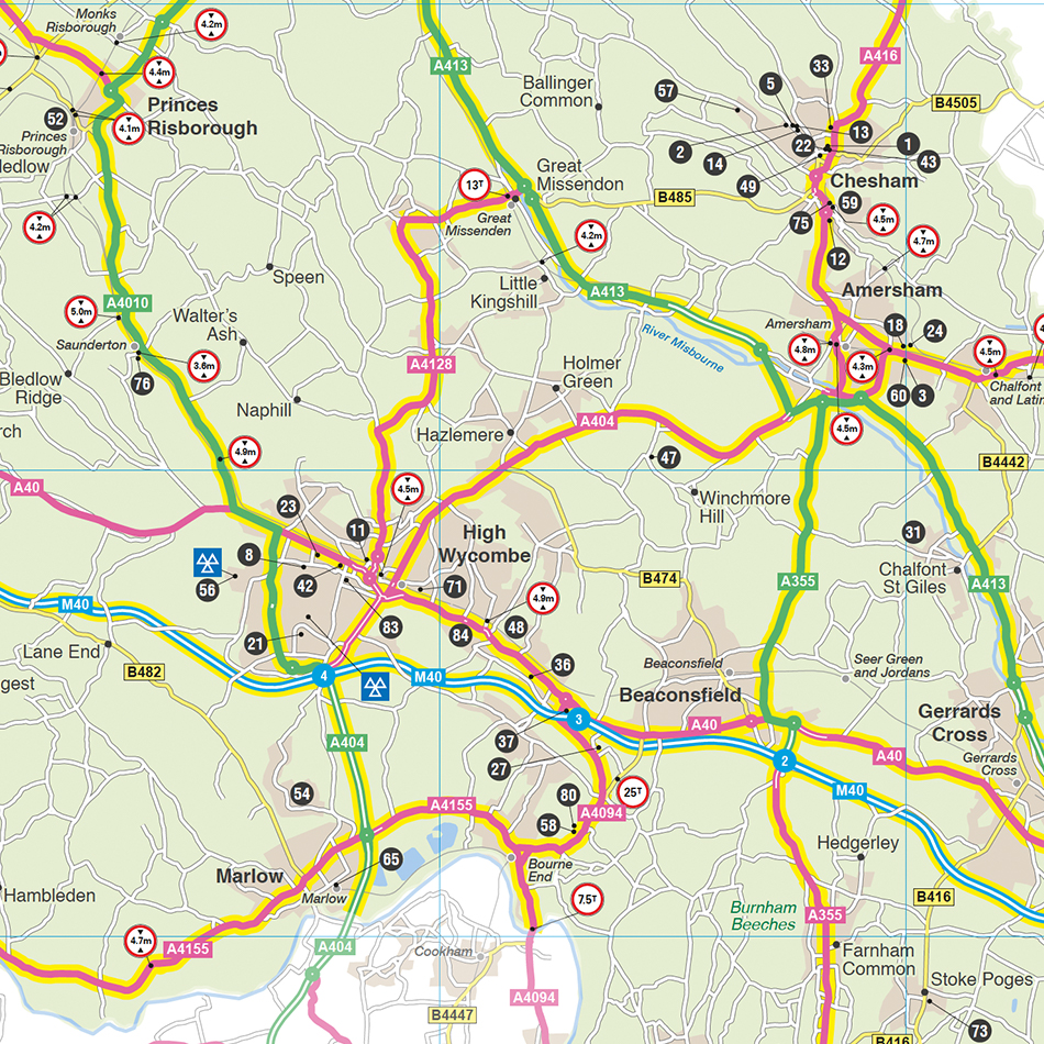
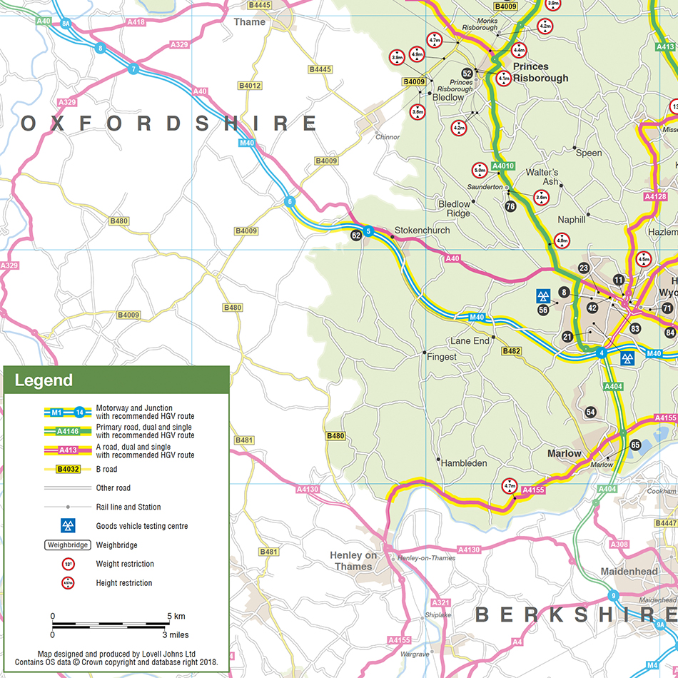
The Buckinghamshire County Council Freight Strategy identifies the preferred routes for Heavy Goods Vehicles (HGVs) across the district, focusing on the major advisory roads, business parks and key destinations for goods vehicles. With so many freight vehicles on the roads, it is important that an authoritative and up to date map is available to the many lorry drivers and operators. With previous similar local government experience in producing such a map for Worcestershire County Council, we were commissioned by the Transport Department at Buckinghamshire to design an up to date county-wide lorry routes map.
Solution
Lovell Johns produced both a county-wide map and a series of town centre maps, with responsibility for data sourcing, data processing and cartographic design. Our cartographers also designed the Key, a listing for the Business Parks and all lay up of the supporting panels of information into finished print-ready artwork. Interim hard and soft copy proofs were provided to Bucks for approval. The maps also feature weight and height restrictions information.
We were grateful to the council for assistance with advice on certain pieces of specialist information such as the location of lorry parks, weighbridges, Goods Vehicle Testing Stations and Advisory Notes.
Result
Buckinghamshire County Council currently uses the Freight Map as a useful tool within its published Freight Strategy.