Requirement
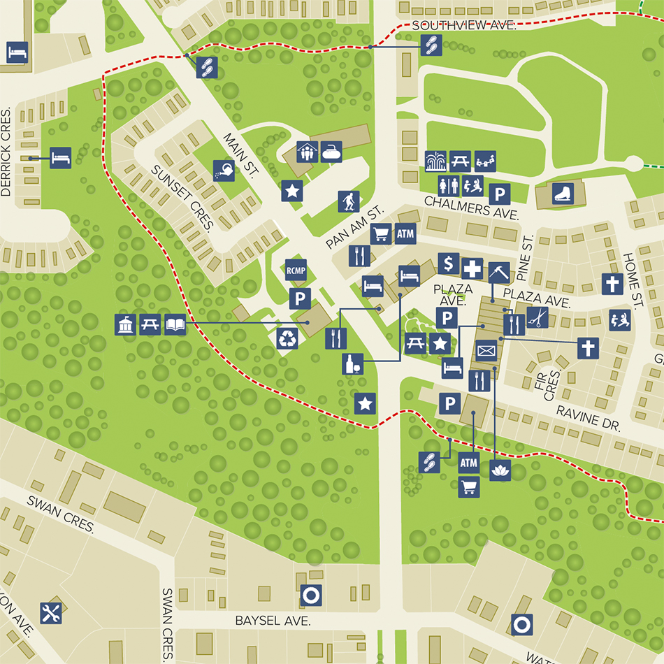
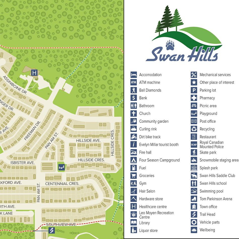
The town of Swan Hills in Northern Alberta, Canada approached Lovell Johns with a requirement for a new community mapping resource for use on their website, on signage and in leaflets. The Town Council had a fairly basic engineering-style map from 2009 but were seeking something more visually appealing to show off the town’s attractions and activities.
Solution
We consulted with Swan Hills to focus in on a suitable style of map. As well as the existing map, the client provided a range of recent aerial photographs, a list of Points of Interest (POI) and popular community trails for inclusion on the map.
Map content was compiled in the GIS-environment from existing plans, satellite imagery and aerial photographs. Google Street View was used to locate and verify POIs. The map provides clear navigation and orientation for the community and for visitors, with detailed street naming and building-shape representation. Greenspace and trails are clearly shown and out-of-town attractions and activities are referenced off-map. There is an extensive key, in all some 85 features across 42 categories are represented and referenced in the map key.
Result
The map can be accessed on the front page of the Swan Hills website.


