Requirement
Lovell Johns were invited to tender by Stoke-on-Trent City Council for a new bus map for North Staffordshire, showing the most up to date services provided by all nine operators in the area. The Council were looking for a new map resource to further enhance their Local Sustainable Transport Fund (LSTF) programme and encourage increased use of sustainable transport across the region. By seeking both printed and interactive formats, the Council were aiming to provide both a traditional easy to carry hard copy map and also a user friendly online map with links to a journey planner.
Solution
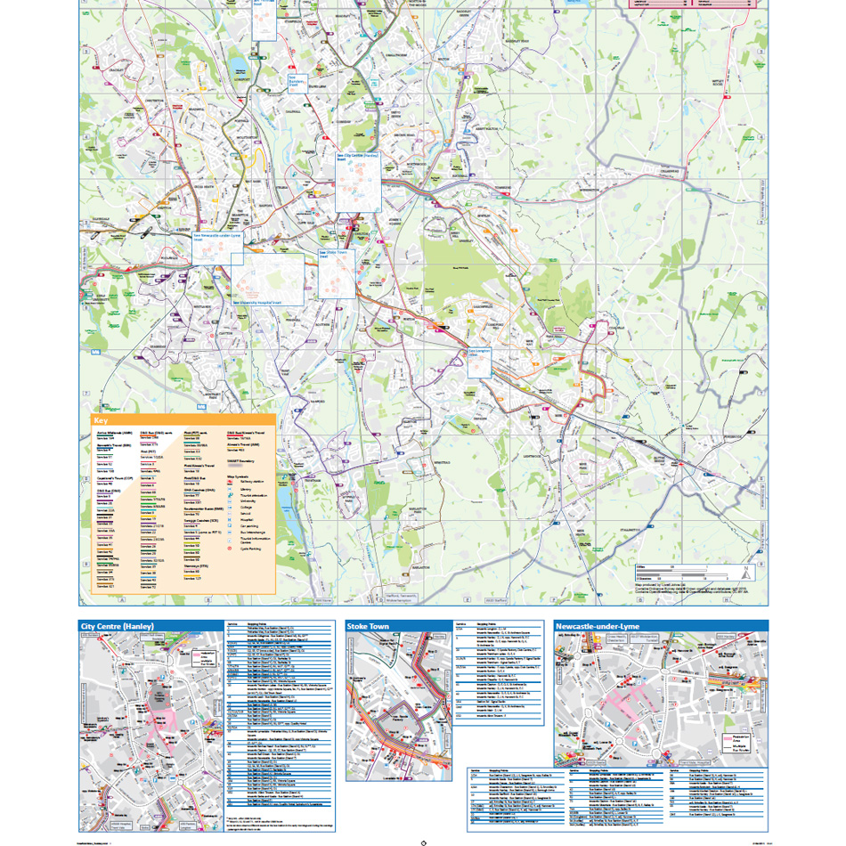
As part of the Tender process, Lovell Johns were required to provide a sample map area to suggest how best to deal with the complexity of individual routes, bus frequency and background mapping. Being based on the existing Stoke cycle map, the new base map was to contain main roads, streets and points of interest such as transport interchanges, shopping areas, museums, key LSTF sites, waterways, railways etc. Lovell Johns were responsible for compiling the essential route and timetable data from the operators. Inset Maps, such as those for Hanley, Stoke and Newcastle were added around the periphery of the main map.
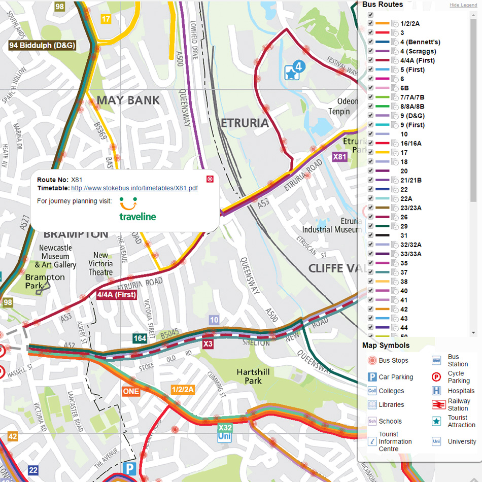
The interactive version of the map allows the user to zoom and pan around a seamless version of the hard copy map with toggle on/off bus routes and useful map symbols. When clicking on a bus route, the user can link to latest timetable information and also so traveline.info for journey planning information.
Result
The project was completed to a tight schedule and both hard copy and interactive versions are supported and hosted by Lovell Johns under a 3 year Agreement.