Requirement
Wiltshire County Council had made a commitment to the provision of cycle maps to cover the main towns in the county. They already provide information on local routes and designated long distance trails but made a decision to invest in a series of cycle maps to encourage people to cycle to work but also to encourage leisure cycling.
The Council had already produced three cycle maps and wanted to expand the range to cover an additional 12 towns in a consistent style. With the specification already existing, Lovell Johns had to match the new maps to this style.
The requirement was for royalty free mapping to use within the cycle mapping guides, so Lovell Johns proposed a mixture of elements from OS open data and Open Street Map. This gave the correct level of detail as required for the project.
Vector data was edited within the GIS environment and restyled on output to the Wiltshire specification. Any final edits could then be made in the graphic environment, such as neater placement of text labels and the adjustment of clashing text.
Solution
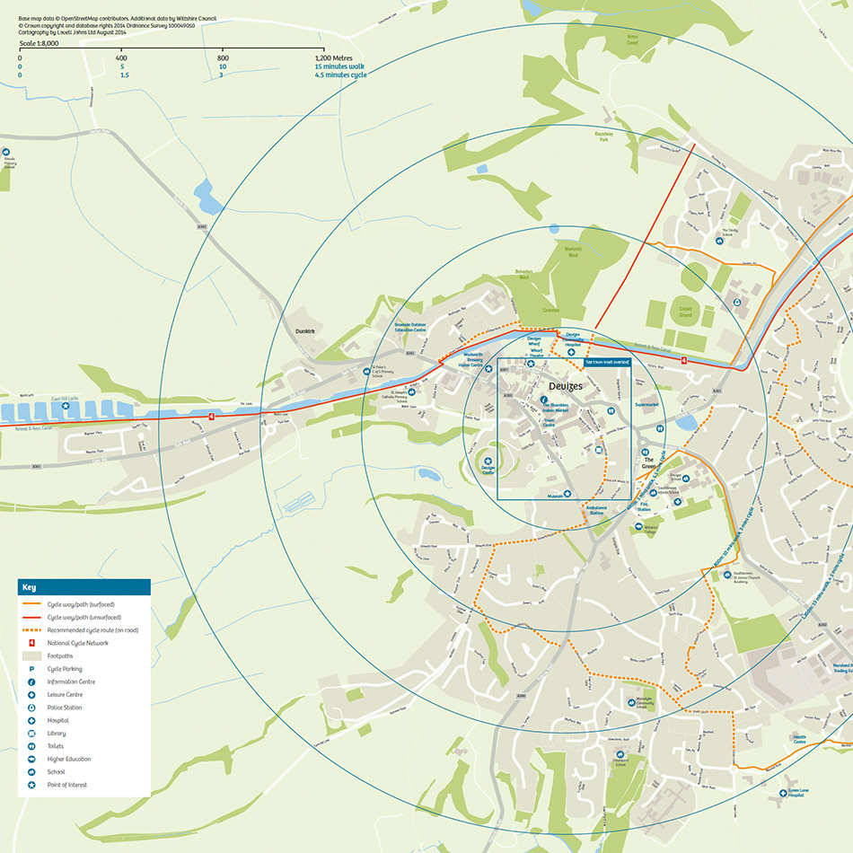
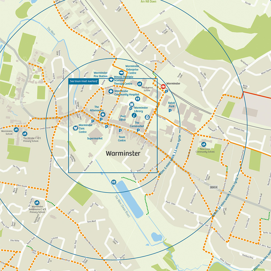
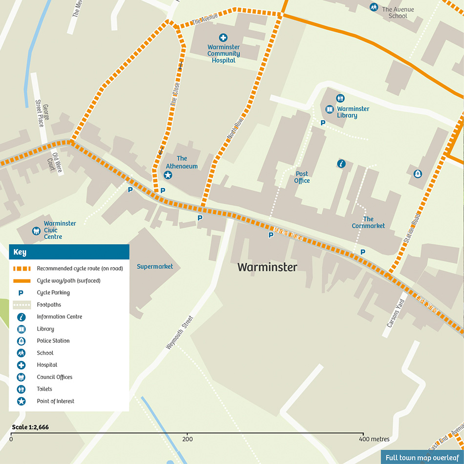
Wiltshire County Council provided the cycle routes as GIS Shapefiles, which were outputted to Adobe Illustrator formats and added into the map, then tidied to exactly match the road layout. The locations of local schools, cycle parking, libraries and local tourist sites were supplied and added onto the cycle maps as symbols, referenced in a key to make interpretation simple.
Radials from the town centre show approximate travel times and distances to encourage people to cycle to work. The mapping is at an appropriate scale to show sufficient detail over the required area. An inset map of each town centre adds useful information in more congested areas to enable safe navigation. Wiltshire provided general textual information to go in each cycle map, as well as specific information for each guide, such as a distance and calorie table to encourage people to cycle to work.
The overall look of the cycle base maps is uncluttered, modern and neutral in colour with clear delineation of recommended cycle routes in a distinct but complementary palette.
Result
The cycle maps fulfil the Council’s brief to make clear, useful mapping to appeal to existing and new cyclists. Hopefully they will encourage people to cycle to work and to use their bikes around Wiltshire. The full range of 15 maps can be seen here.