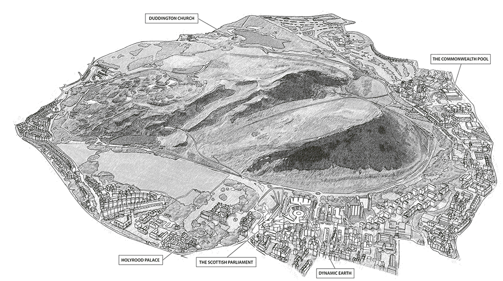
From start to finish, illustrated maps as a process or project give cartographers a lot to think about.
The first major decision to make when engaging with an an illustrated maps project is to decide, in consultation with the client, on the style of mapping they are looking for. Whether it be a unique, hand-drawn watercolour with a great deal of detail, or a more architectural looking map with realistic building facades, this is where a project should begin. The best option is to show a client a wide range of styles and let them choose the most suitable illustrated map for their requirement. There may be constraints of budget, publishing schedule, or the scale of the map and its’ ultimate use, and all these options must be considered.
Lovell Johns have a wide variety of map illustrators and can select from a range of styles to suit a customer’s requirement. We use the examples on our website as well as a catalogue of other maps we have produced as a means to define the type of mapping required and can talk a client through what will be involved with an illustrated map project.
Most illustrators can produce an initial sketch to check the coverage and content of the map area, provided in a variety of ways, from a hand painted base to a digitally created map, depending on the final style. This proof is checked by the client before proceeding to start work on the main map. Additional layers of information are added, such as road networks, icons and 3D buildings. These are usually stored on different layers for flexibility of positioning and further editing. It is important to engage with the client throughout production to ensure that the illustrated map is developing as expected as it can be difficult to make major changes later on in the process.
There are several considerations when commissioning an illustrated map:
- Where will the map be used; is it for an A5 leaflet or an A0 location board? This will define the resolution and scale of the finished product.
- How much detail is required? Can points be shown with symbols, or illustrations? Are 3D buildings a useful enhancement to bring the map to life?
- Who is the final user? Does the illustrated map need to be functional for wayfinding on a University campus or can it be more artistic and engaging for a country estate or campsite?
- Budget – this may constrain the style of map as hand drawing a lot of individual icons will add to the production costs
After addressing these points, there should be plenty of information to create the perfect illustrated map!
Comments are closed here.