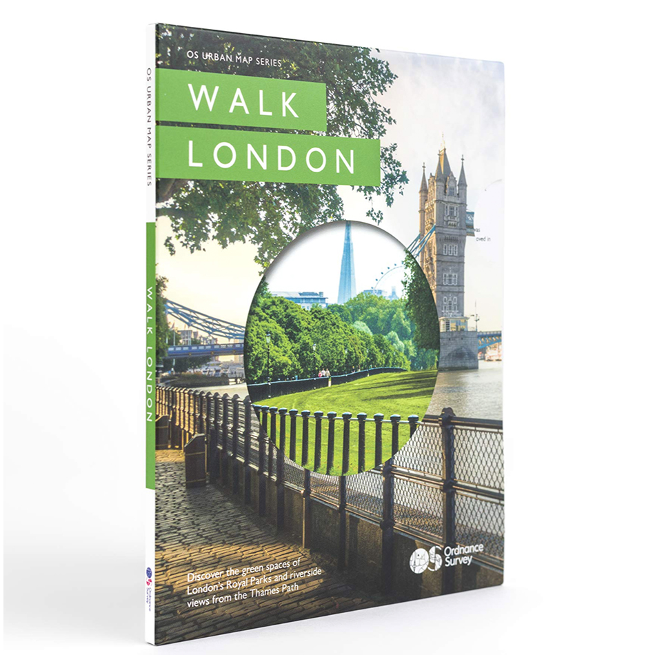
A hand-illustrated map of London city walks and open spaces
Requirement
Ordnance Survey have launched Walk London, the first in a new series of Urban Maps providing city walking routes along the banks of the Thames and through three Royal Parks. Lovell Johns were commissioned to provide all map creation and typesetting services for the new printed product, the challenge being to create something both beautiful, informative and encouraging customers to explore London’s green spaces and waterways.
Solution
Our cartographic design team provided a wide range of services including:
- Data source review, determination of geographic scope and scale
- Establishing initial mapping stylesheets, incorporating OS branding
- Pagination of the Thames Path and Royal Parks into appropriately divided panels
- All map illustration and symbology design, including key Points of Interest
- Consideration of accessibility issues for different user groups
- Non-map panel design
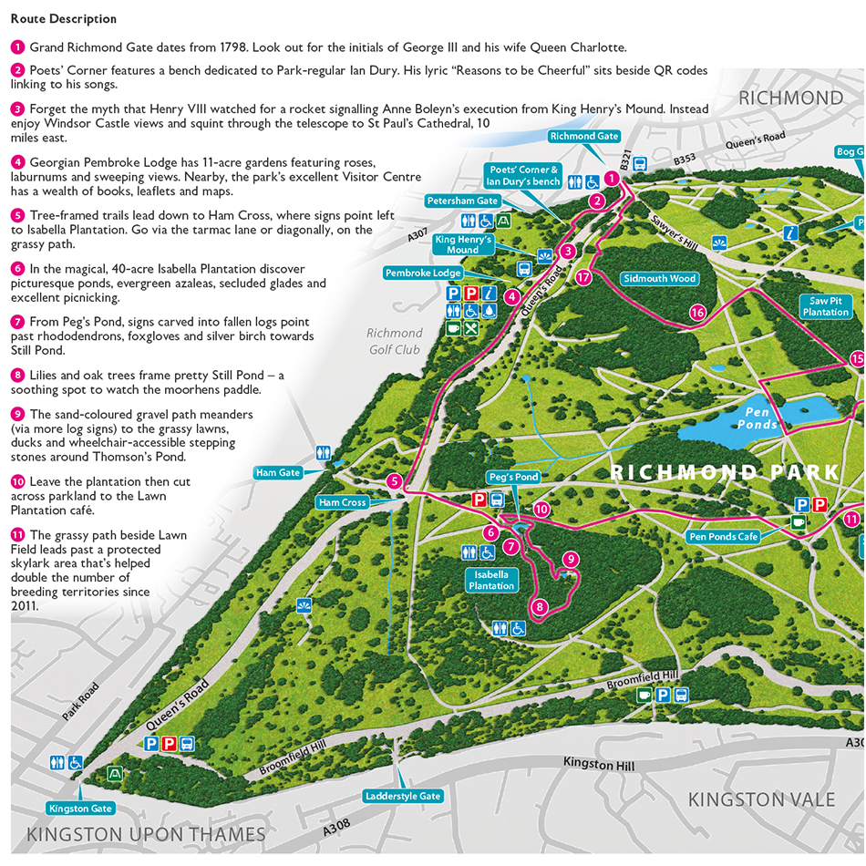
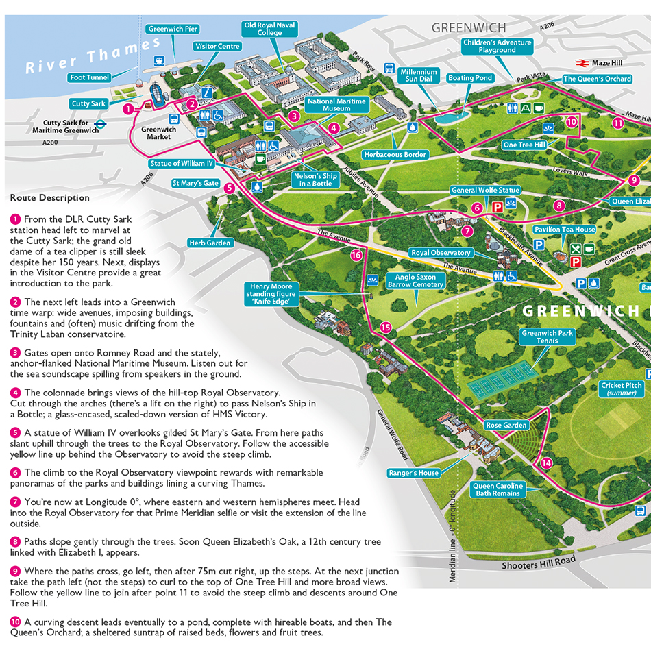
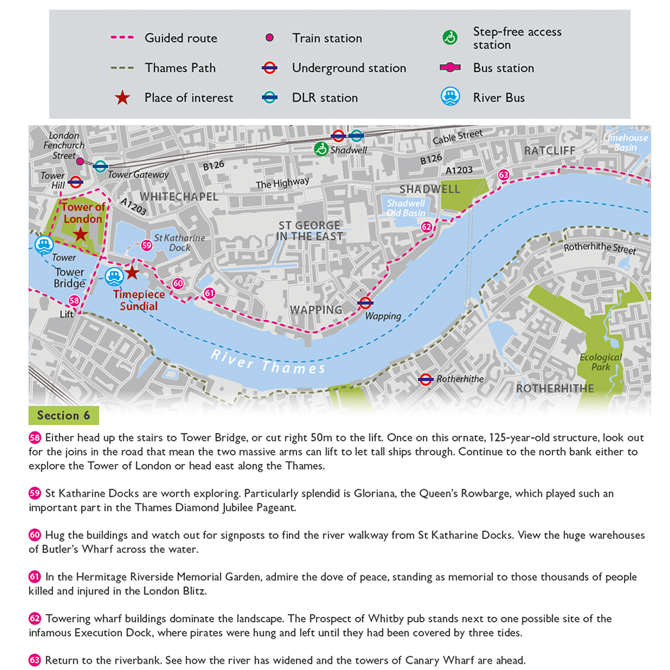
The double-sided A5-sized map features the Thames Path from Richmond in the West, all the way across to the Cutty Sark at Greenwich in the East (23 miles), pointing out 75 (numbered) Points of Interest and way-finding locations along the way. The reverse side depicts three separate walks on Richmond Park, Hyde Park & Kensington Gardens, and Greenwich Park, again with numbered Points of Interest for each.
Result
The completed illustrated map is small enough to be displayed on a till counter and sits comfortably in the hand and is held open like a book when in use. Ordnance Survey have tried to create something more than a simple map/guidebook by using detailed and realistic illustrations of the cities and parks to differentiate it from the usual inner-city maps available.
Paul Cross from Ordnance Survey commented:
“Working with the team at Lovell Johns was a superb experience. They very quickly grasped the concept of the project and worked diligently to solve any design issues and gather the data and resources to complete the project. This wasn’t an easy brief and as a consequence there were several complicated moving parts to this project. This wasn’t an issue as the team liaised with the different agencies involved to ensure everything was delivered on time, within budget and kept me up to speed as it developed.
It was a brilliantly collaborative effort between us all and I think we produced something that not only fulfilled the brief perfectly but also produced something uniquely beautiful. Special mention must go to Louisa and Clare for their cartographic knowledge and having a great eye for detail and design. Lovell Johns proved to be accommodating, flexible and professional. Clearly they all love making maps, and I very much look forward to working with them again in the future.“