What challenges to do cartographers face when translating maps?
As with any publication designed to appeal to a wide audience, maps are frequently produced in different languages – to appeal to a local market, for educational purposes or to be used by an international customer.
A world atlas may contain text in a local language and more familiar names in parentheses, for example, Kriti (Crete). Local variants may not be as well known, or an alternative form more widely used, and it is important to reflect this on the map so locations are easily identifiable.
As a cartographer, producing maps in different languages can present some issues.
Some languages are inherently longer than others and therefore when a term is translated, it may need to be reduced in size to fit in the same space. The German language is estimated to be 10% longer than English so a map translated into this language may well present challenges of text placement and spacing. The cartographer may reduce or compress the font or change the kerning (space between characters) in order to retain the optimum legibility of text. This is a particular issue if there are large sections of text included, such as on a leaflet or guide.
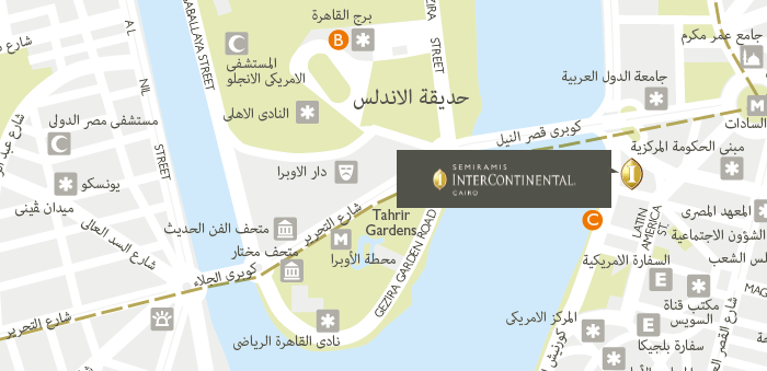
Cyrillic, Arabic, Chinese and Japanese fonts are naturally all treated differently. For example, Arabic presents particular issues as it reads right to left, requiring all text to be justified in this fashion and therefore placed appropriately.
Text with accents can create a challenge as these are prone to print incorrectly, requiring the embedding of particular fonts to overcome this.
Lovell Johns developed a European Union database that contains translations of all the European language versions of country and city names, including Cyrillic. Each of the different translations is stored in a different layer for easy manipulation.
The challenge with this type of map in different languages is that the labels should fall in the same place on each version of the map and therefore have to be placed with a view to accommodating the longest label comfortably but also ensuring that each individual language does not overprint another. Also, if a name is changed, it has to be updated in several different languages.
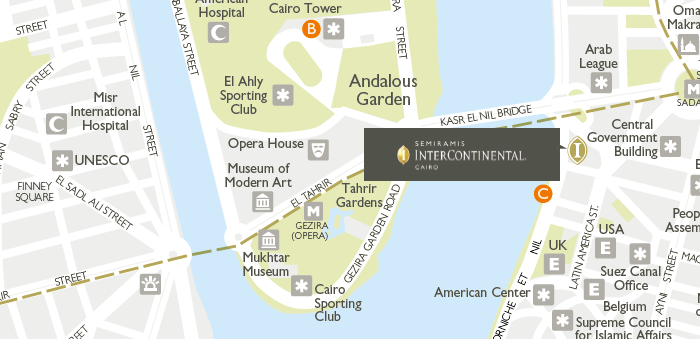
Another challenge of producing maps in different languages is the quality of the translation. If the main language used is English, how confident can the cartographer be that a non-Roman language translation is accurate? It is important to always use a trusted source (not Google Translate!), preferably a native speaker and ideally someone with geographic knowledge. Any translation to a different language needs to be carefully proofed and checked. There may not always be an accurate translation, so either the text can be left in the native language or excluded, depending on the importance. In the example image above, some road names could not be translated into Arabic, so have been retained in English, at the client’s request.
In summary, while preparing maps in different languages does present unique challenges, each of them can be overcome with careful proofing and positioning of text labels.
Comments are closed here.