Detailed 3D visitor map for Royal Navy Museum
Requirement
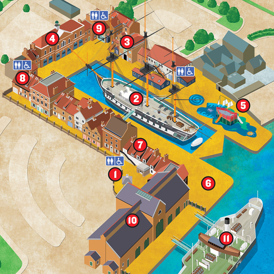
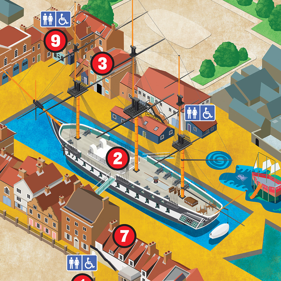
The National Museum of the Royal Navy, with six sites across the UK, were seeking a new illustrated map for the Hartlepool site to be used on visitor signage and for website display. The Brief was refined with their Campaign Manager and a 3D perspective view map-style chosen.
Solution
Prior to design work starting, we agreed on the map final footprint and preferred angle of view with the client by providing aerial imagery screenshots. A series of iterative proofs were provided during the 4 weeks delivery timeline. The map is drawn in a highly illustrated style, depicting building frontages and tall ships.
Result
The map clearly highlights the key visitor attractions across the site very well. Lovell Johns supplied high resolution files for print and web use. The map was delivered in time for the summer season and NMRN’s Catherine Scott commented ‘Thank you so much for all the hard work on this.’