A series of 25 artistic maps of 1944 for publisher Penguin Random House (PRH)
Requirement
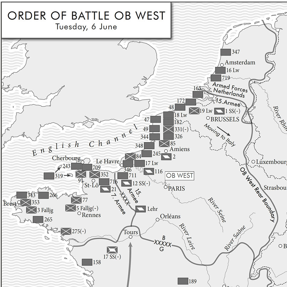
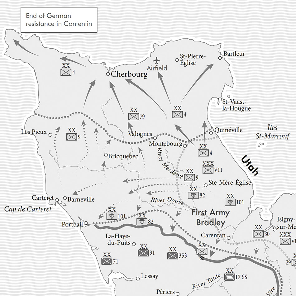
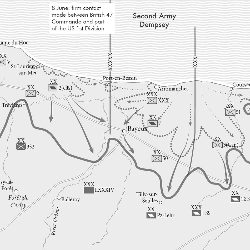
Lovell Johns have worked on several projects for Penguin Random House (PRH), where mapping has been required for insertion into a publication. A new book about the D-Day landings required a set of artistic maps showing the stages of battles in a certain area of northern France.
Solution
Our challenge for this artistic maps project was that the road and rail infrastructure was different in 1944 compared to today. Therefore, we had to use various sources to supplement modern map data, to reflect the transport network at the time. PRH supplied us with sources to help with the selection and seven generic base maps were made, so that each could be adapted to make several maps from one base. PRH also supplied a detailed brief from the author, listing features to show.
The maps were created to a consistent style across the range. The mapping is simple and concentrates on the detail of the battles rather than extraneous features which may confuse the message. Maps were supplied to the publisher in batches for checking, and amendments made promptly.
Result
In total, we successfully delivered 25 maps. The client was happy with the work produced and commented:
“Both we and the author, James Holland, are delighted with the end result and Lovell John’s ability to interpret complicated references of varying quality!”