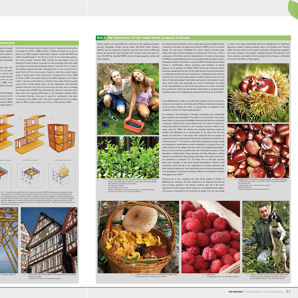
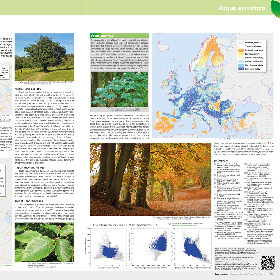
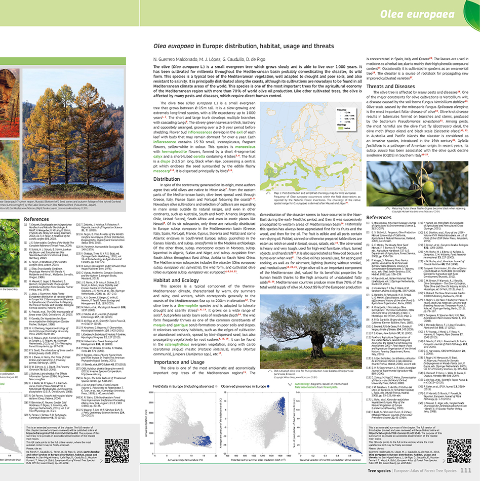
Requirement
The Joint Research Centre (JRC) is the European Commission’s science and knowledge service providing scientific research and analysis to support policy-making. It publishes thematic atlases on a wide range of environmental topics including Soil, Radiation, Water and Forest Tree Species. This first edition is a comprehensive publication of tree species across Europe, with contributions from leading scientists and forestry professionals.
Solution
With Lovell Johns providing cartographic services to JRC and the wider European Commission for over 20 years, including the range of Soils Atlases, our team of cartographers were able to use their experience gained on other atlas production programmes. We provided a range of atlas mapping services to assist with the transformation of map-based and textual information into a finished atlas, supporting the publication of thematic atlases with map design, GIS data manipulation* and atlas publication services. Specifically, our staff provided expertise in:
- GIS data processing and map conversion services
- raster map image manipulation
- cartographic enhancement of JRC data
- graphic design services including typesetting, creation of infographics and diagrams to help communicate the scientific issues discussed
- proofing, consistency checking and final print-ready file delivery
Result
The European Atlas of Forest Tree Species is a 200 page, A3 size printed atlas focusing on European Tree Species with a dedicated chapter for each major tree species. The atlas features textual description and high quality photographs and map images showing the spatial distribution of species across the continent. An online version is planned allowing a dynamic updating of information for the scientific, research and educational audiences.
*Aside from cartographic services we also conduct digital mapping and provide expert GIS data services from data capture and conversions, database builds and sourcing GIS data through gi Perspective.