Requirement
Swiss Farm is a large touring and camping site outside Henley-on-Thames, who approached Lovell Johns with a requirement for a new site map. The brief was to provide one detailed map of the facilities available on-site, and another wider map to show the location of the campsite in its local setting.
Solution
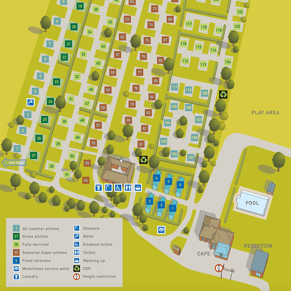
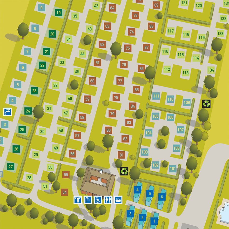
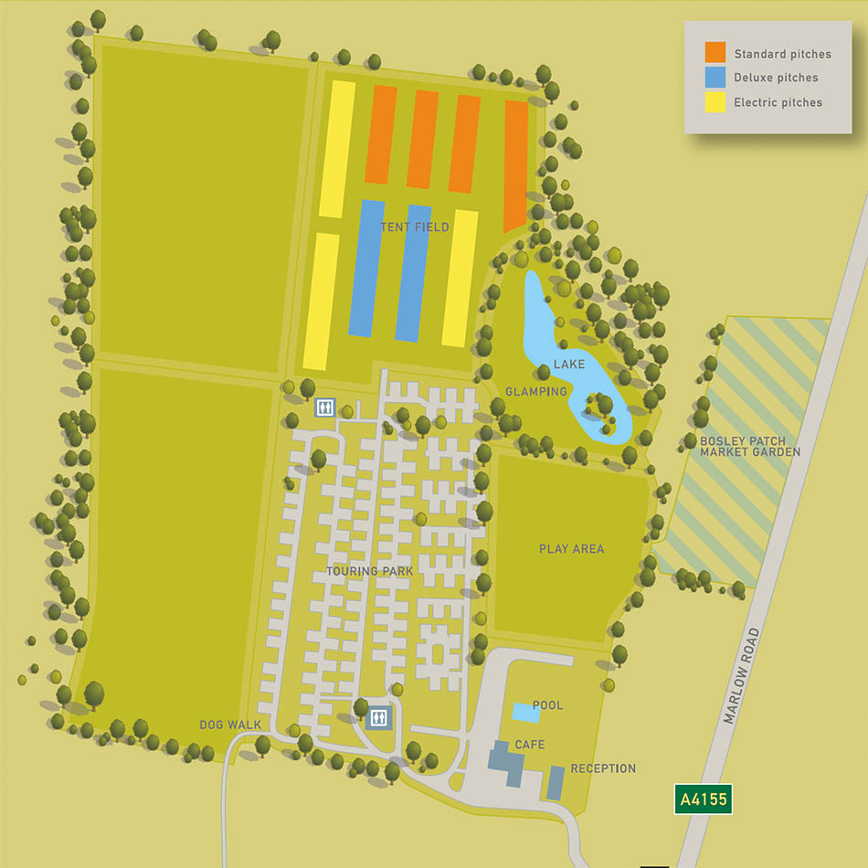
After close consultation with the site owner, it was agreed that a simple but illustrated map would best provide the desired look and feel of the site. Lovell Johns were able to show a wide range of styles to help refine this requirement. The detailed site map was produced from hand-annotated originals, photographs and architectural plans, with various stages of input from the client.
All pitches were marked with coloured annotations to denote the type of surface and facilities available and all key buildings are shown with 3D icons to give the map some depth and interest. The wider map shows the campsite in its local setting within the surrounding countryside and is in a similar style to the campsite detail map to give a consistent look across the two images.
Result
The maps were required for the opening of the site for the Summer and are used in booklets and on their website .