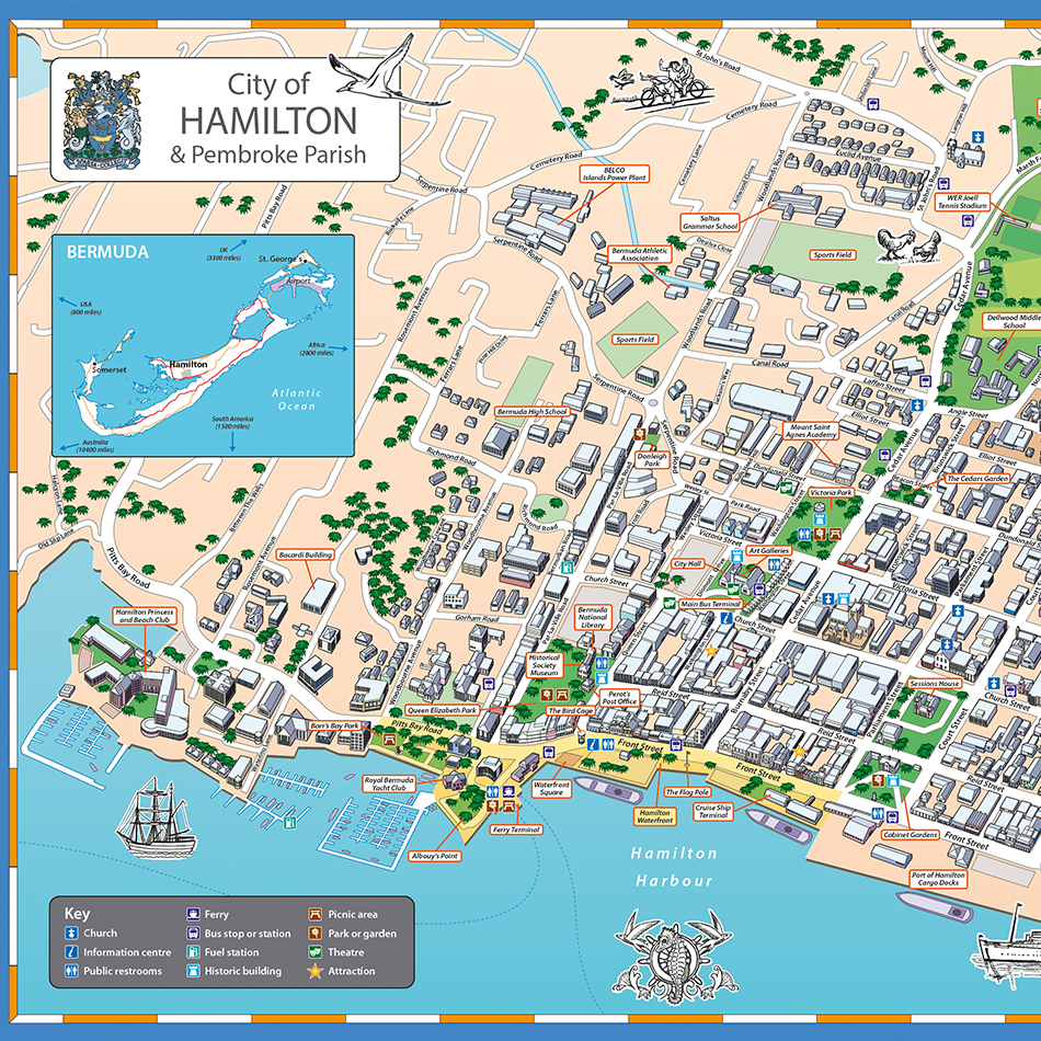
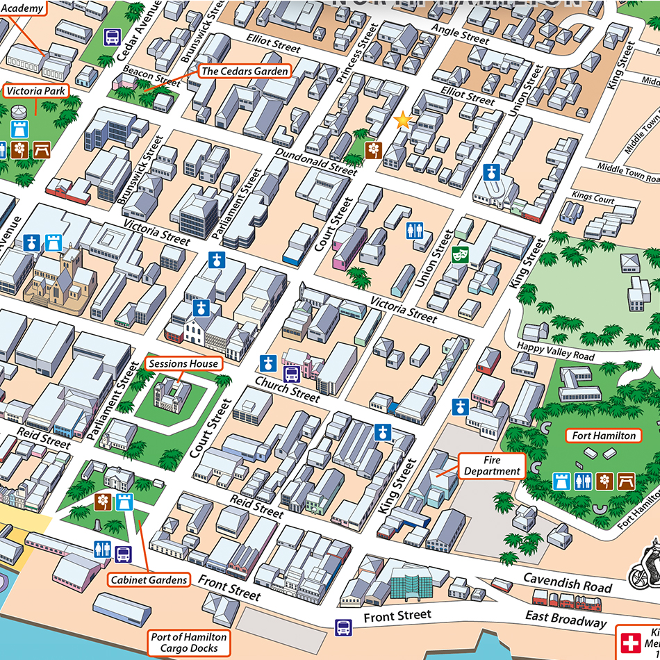
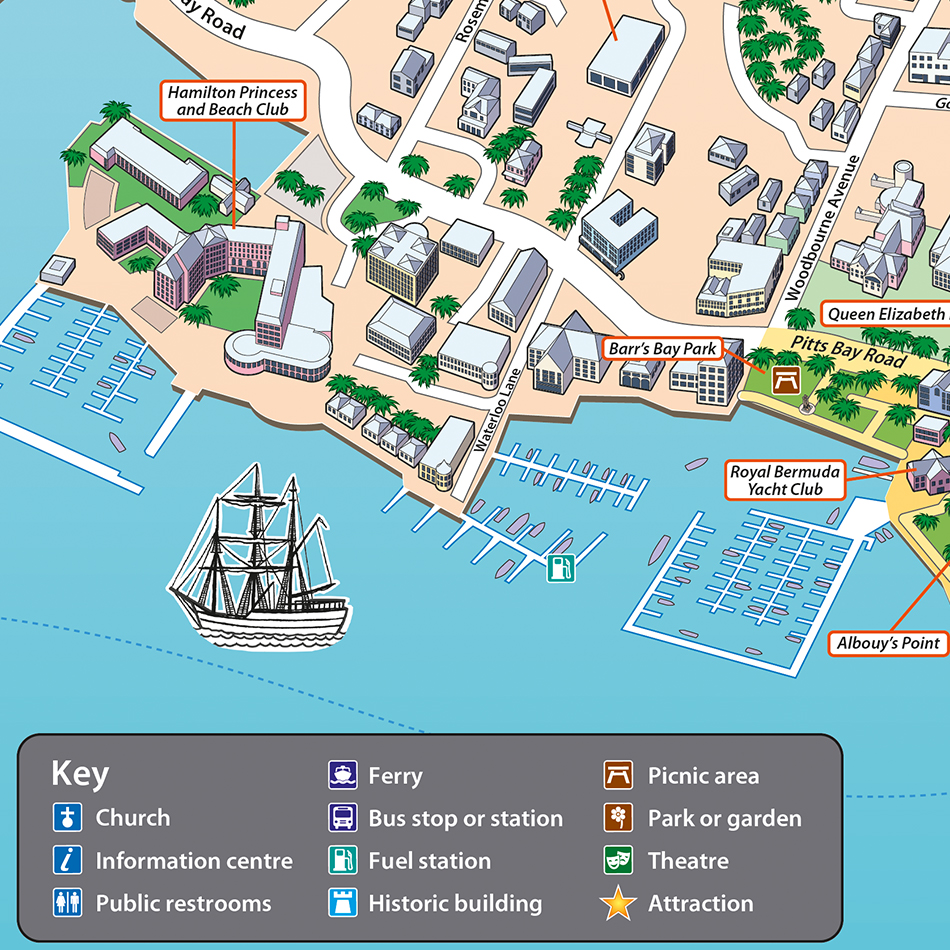
Illustrated map for tourist arrival point
Requirement
The City of Hamilton is Bermuda’s capital, also its main port and tourist destination. The City Council approached us with an interest in commissioning a 3D illustrated map of the city to assist visitors with navigation and orientation in areas of high footfall. Our client also wanted the new map to fit existing signage dimensions.
Solution
During the enquiry stage Lovell Johns put forward different styles of illustrated maps, also agreeing on the coverage area and level of detail required to arrive at a fixed fee for the commission. From speaking with the client we understood that the map needed to be drawn from the Inner Harbour in the South.
Result
Green spaces are highlighted across the city. Key buildings such as the City Hall and those along the waterfront are drawn in more detail for wayfinding and interest, while other buildings are generalised. On-map labelling of key points of interest is achieved using callout boxes. A key references the map symbols and a smaller scale Inset Map shows where Hamilton is located on Bermuda itself.