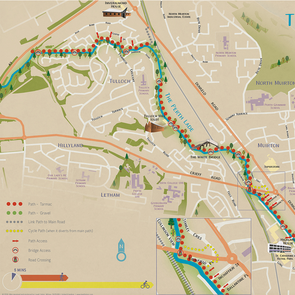
Requirement
The Lade path is a 4.5 mile long historic walking and cycling route with easy access from many residential areas. As a convenient route for both regular journeys and as a pleasant option for leisure walks and rides, Perth and Kinross were hoping to inspire people to get out and explore. The Transport Planning Team at the Council contacted Lovell Johns for specialist map design for a new leaflet to encourage active travel in the area.
Solution
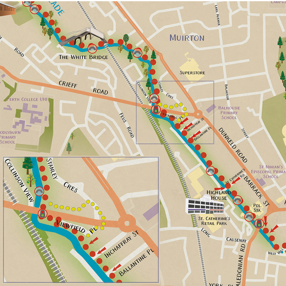
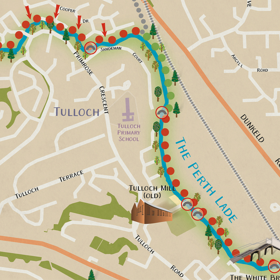
Lovell Johns were able to put forward examples of previous illustrated maps and then discuss how to promote it as an attractive route for both pedestrians and cyclists. The map highlights the core active travel route to the city centre and shows links to residential areas.
The different categories of path such as tarmac and gravel are referenced in the Key, also a guide to how much distance you can cover in 5 minutes on foot and by bike. Key features such as The White Bridge and Tulloch Mill are illustrated in a 3D style.
Result
The map leaflet was funded by the Smarter Choices Smarter Places programme and can be downloaded from the ‘On The Go’ programme page on Perth and Kinross Council’s website.