Requirement
Seren are Wales’ leading independent publisher, producing English-language books covering a variety of topics relevant to Wales. They were looking for a cartographic company to produce some maps to illustrate a book on a circular long-distance walk around Cardiff – Edging the City.
Solution
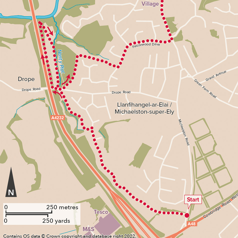
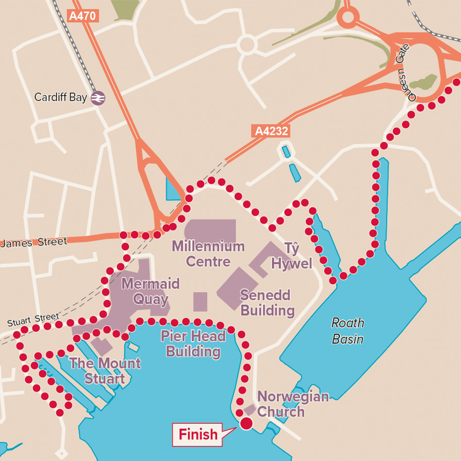
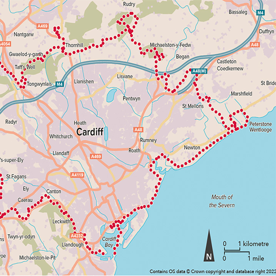
The client supplied seven digital route files as overlaid on a generic mapping base as an example of the type of mapping detail required. Lovell Johns then selected the appropriate open data for the base mapping and split the route into the 30 stages agreed. Mileage markers were added to the paths and an overview map was also produced to show how all the routes relate.
The maps were created at a variety of different scales, to maximise the information on each page. A simple style was selected, based on our map of Perth and Kinross:
https://www.lovelljohns.com/case-study/illustrated-maps-for-perth-and-kinross-council/.
Result
We worked on a single map in order to agree the style with the publisher before producing all 31. The maps clearly show the walking route as well as a basic amount of wayfinding detail to help navigation, using a neutral colour palette.
Mick Felton at Seren was happy with the service commenting “We couldn’t have had a smoother consultation and generation of the maps for this title: Lovell Johns gave us great guidance and accommodated our particular needs for this very particular book.”