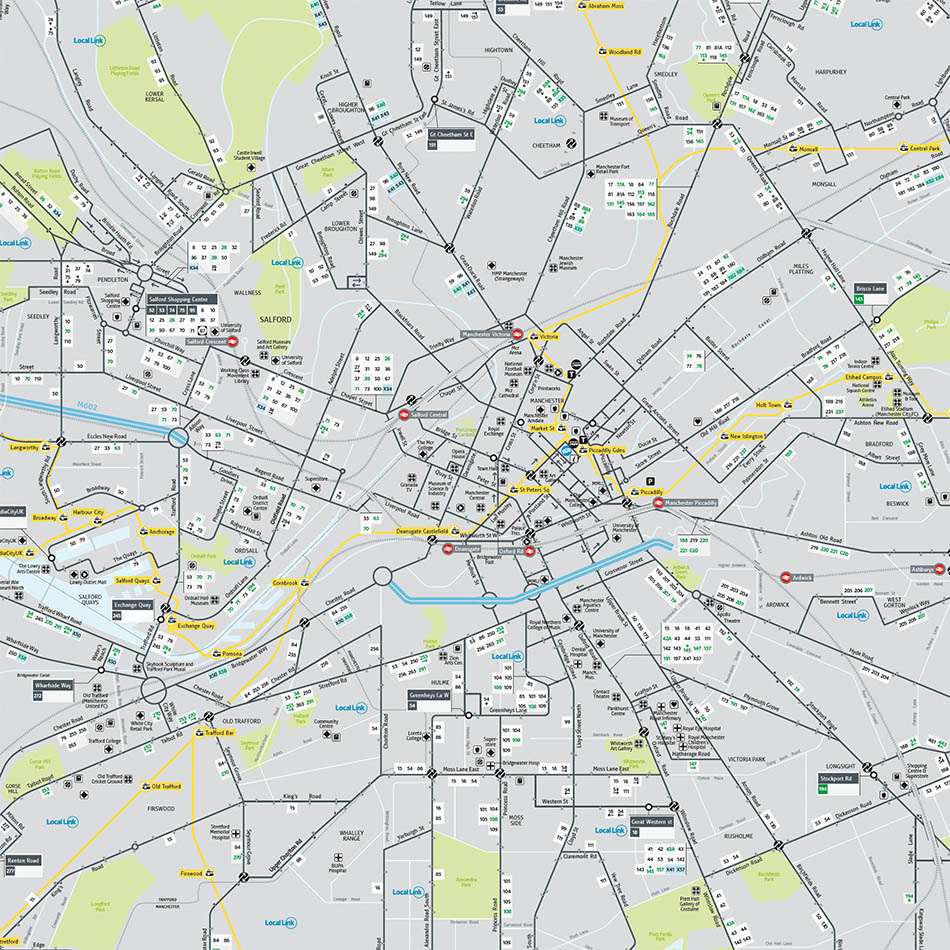
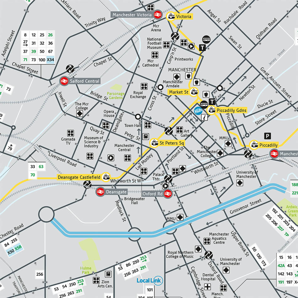
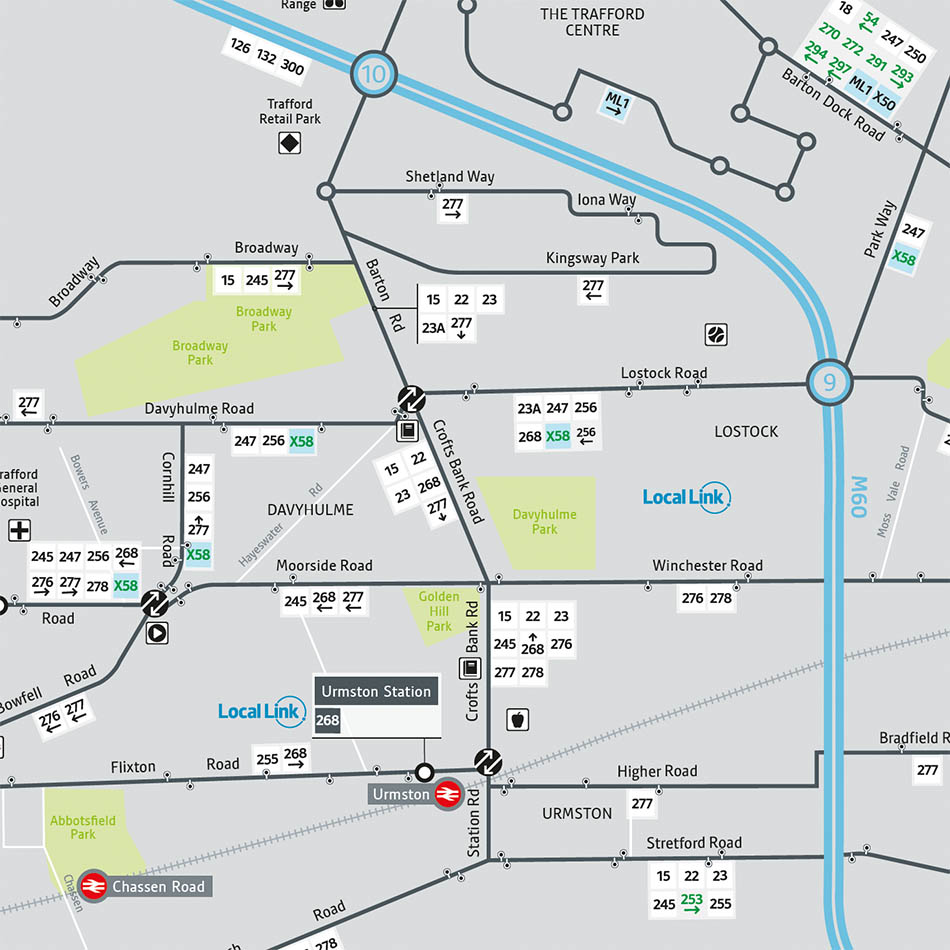
Requirement
Transport for Greater Manchester (TfGM) had already piloted a new design for the Greater Manchester Network Map in a test area display with supporting web and PR exposure. In exploring options for rolling out the design to cover all areas of Greater Manchester, TfGM required a redraw of the full County wide map to the new specification and stylised alignment and were therefore looking for specialist cartographic skills
Solution
The existing Adobe CS6 Illustrator files were supplied in order for a new master map to be drawn in the same software package, to the same scale and style. Lovell Johns consulted with TfGM regarding the new map style and clarification on any other information to be amended, set up the required “style sheet” to ensure consistency across all mapping and then restyled the existing mapping to the new style. Linework was also re-aligned to match the new “tube” style mapping already piloted. Quality Assurance checking was provided by a second cartographer and open files supplied.
Result
The work was completed for a fixed price, won through a tendering procedure and delivered to an agreed schedule to a specific design.” TfGM have been supplied with a County wide transport map, focusing the map on public transport services rather than a true geographic road map.” The client commented “Once again, thanks for all your hard work on this (to you and your team). I would like to thank you for what you have done – we all really appreciate what you have achieved.”