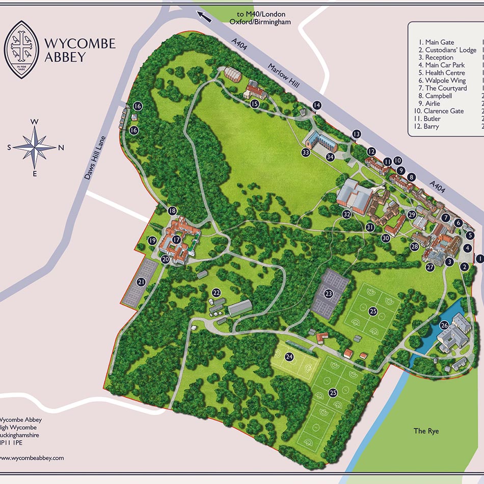
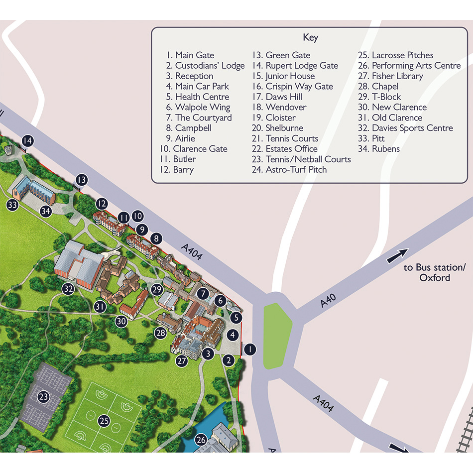
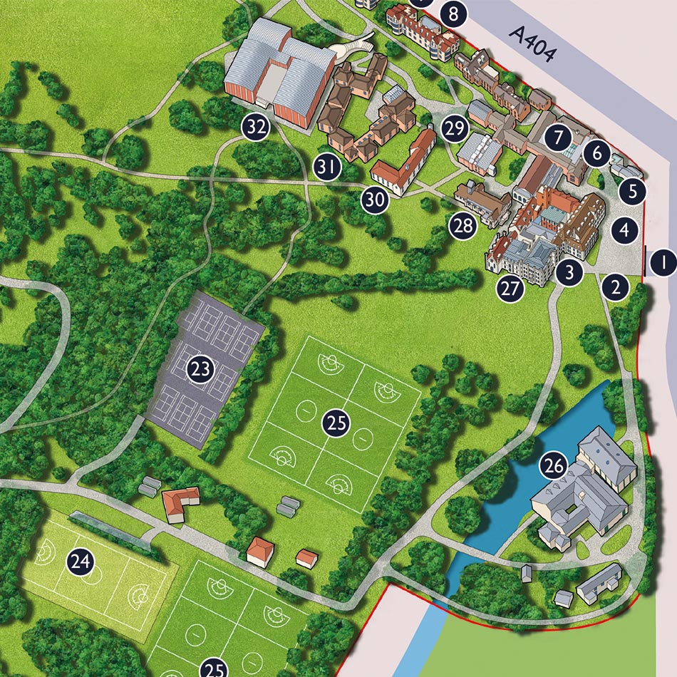
Requirement
The Estates Directorate of Wycombe Abbey School approached Lovell Johns with an interest in developing a 3D illustrated campus map. The school had an outdated map and wanted to develop an informative and accurate visualisation of their unique site to assist the different visitor groups.
Solution
We consulted on appropriate styles of illustrated maps, using some of the examples of site plans and campus maps on our website, that would best suit the bowl-shaped 170 acre woodland site of Wycombe Abbey School. Our cartographer also visited the school to take photographs and get a feel for the landscape and buildings.
We were instructed to bring out the detail of the buildings and sports facilities, also to convey the greenness of the site and reference the main access roads.
Result
The map was reviewed by different stakeholders throughout proofing stages and has been used in various publications. The map has subsequently been adapted for different uses, such as sports and facilities management.