Key Drivers
It is well-documented that for several years now local authorities have been adopting sustainable travel policies and promoting modal shift away from cars towards active transport. Transport strategists have already taken various steps such as infrastructure improvements in the form of Park and Ride facilities, Low Traffic Neighbourhoods and improvements to cycle lanes and pedestrian access, in an effort to encourage behaviour change amongst citizens.
Following the Government’s previous commitment to £2billion worth of funding for walking and cycling, 2022 sees the establishment of a new Department of Transport executive agency – Active Travel England – which shall assist local authorities in rolling out improved active transport provision across the country.
With these latest plans it seems that we may see a major step change in how this behaviour shift towards more physical methods of transportation is achieved. As part of the mix, the provision of clear, accurate and accessible cycling, wheeling and walking maps can play an important role.
Good Map Design Principles
A well-designed cycling, walking or wheeling map can highlight the new infrastructure being rolled out, promote the use of quieter roads and dedicated cycle lanes across towns and cities, as well as make commuting and leisure trips safer and more attractive to first-time cyclists and highlight traffic-free access for pedestrians to use safely.
A good cycle map will clearly display recommended routes, whether they are dedicated traffic free paths, suitable quiet back streets or cycle lanes around obstacles such as roundabouts. The map can highlight local landmarks to aid orientation and navigation, also detail useful associated information such as cycle parking/storage, bike shops and cafes.
Active Travel for Business
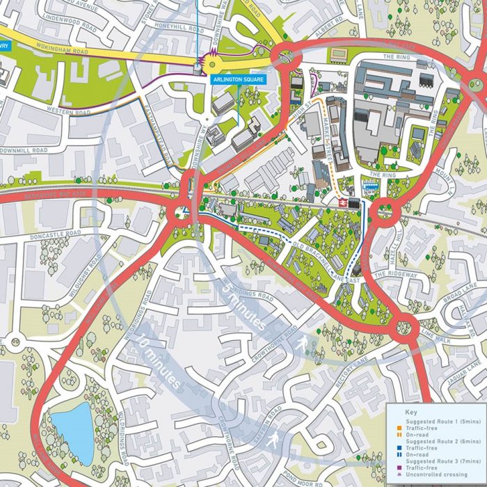
The travel map below helps direct commuters from the bus and railway stations to two key employment areas, promoting walking or wheeling for the ‘last-mile’. The base map design is simple so that the supplementary information stands out clearly. Pedestrian routes, traffic-free and on-road routes and uncontrolled crossings also feature on the map. 5- and 10-minute radial zones help to encourage active transport. Key landmarks and additional features such as trees were drawn in 3D to ‘lift’ these important map elements and give the map some depth and interest.
Active Travel for Leisure and Activity Cycling
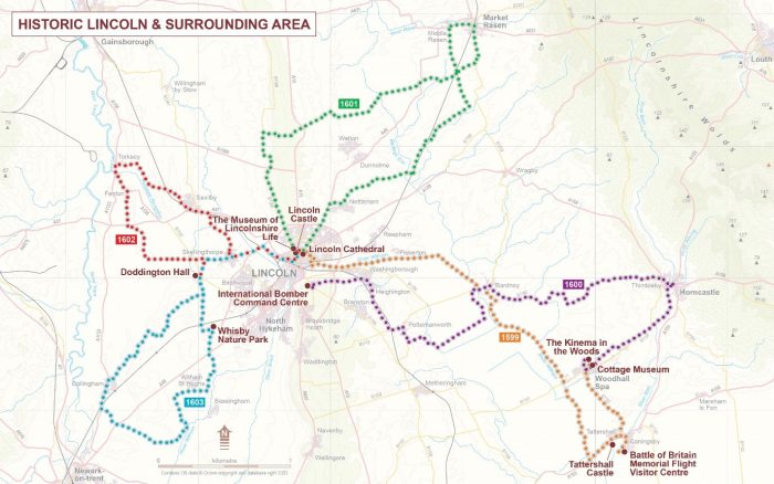
The Cycle Map design example below for Lincolnshire covers a much a wider geography, encouraging the leisure or activity cyclist to get out into the surrounding countryside. Each map contains specific landmarks and points of interest with the routes highlighted in a strong colour against a deliberately simple base map. This also map features the National Cycle Network routes.
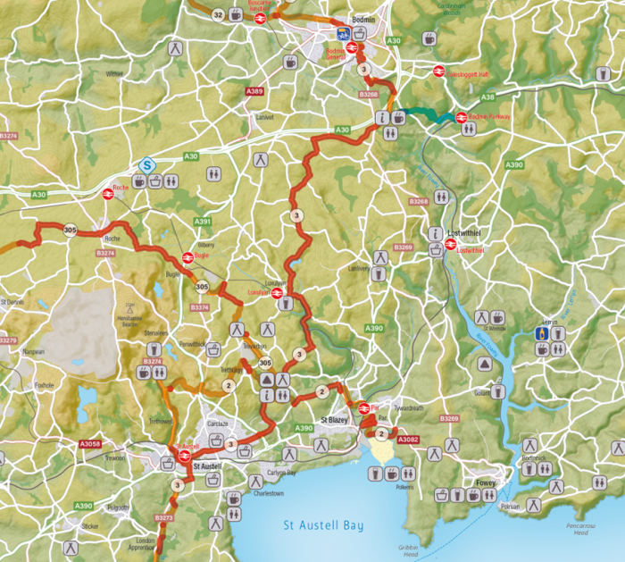
The cycling map of Cornwall below uses a host of symbols on the map to help the user plan their journey with confidence in where to stay overnight or stop off for refreshments. The map is very clear and easy to read but also helpfully features the network of connecting smaller roads to allow the cyclist some freedom to explore.
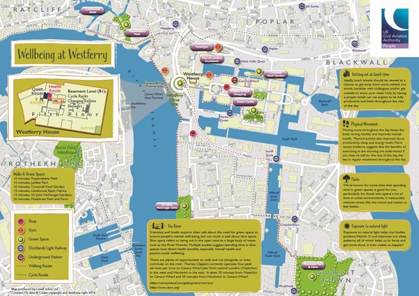
The map below is part of a Wellbeing Strategy, encouraging people to get out and about from their workplace and explore the local area. This map features local cycling and walking routes, transport hubs, cycle racks, local shops / food retailers, public gyms and swimming pools, green spaces (picnic sites, parks, nature reserves, etc.), shops / post offices, etc.
Go online
As well as PDFs and printed maps and leaflets promoting Active Travel, online delivery can provide more immediate inspiration for activities for the general public. Online maps provide an interactive experience where the user can zoom in through multiple levels of mapping down to street level, filter layers of bus routes, bus stops and cycle routes. Additionally, online maps can then link to further supporting information such as live timetables and routing facilities.
We all know that Active Travel can have a positive overall impact in terms of Environmental, Health and Financial effect. However, citizens also need to be provided with improved information on the sustainable travel options available and this is where marketing materials like cycling and walking maps are particularly useful.
Comments are closed here.